Monitoring global flooding from direct broadcast flood products
As weather and climate conditions that favor flooding increase due to climate change, global flood monitoring is more important than ever.
To meet the growing challenge of monitoring floods, researchers at the University of Wisconsin-Madison Cooperative Institute for Meteorological Satellite Studies are taking advantage of high-resolution satellite imagery to detect where they may occur and how people, cities and rural areas might be affected.
“We don’t just show where it’s flooding,” says CIMSS scientist William Straka III. “The flood products from satellite data could be used to derive other pieces of information like what populations are impacted by the flooding or what amount of cropland might be impacted or where there is structural damage.”
Straka and Jay Hoffman, also of CIMSS, are collaborating with Sanmei Li of George Mason University, who is the algorithm developer for the flood product. This team developed global flood products that incorporate remote sensing data from several satellite instruments including the Visible Infrared Imaging Radiometer Suite, the Advanced Baseline Imager, and the Advanced Himawari Imager. These flood products use direct broadcast data to gather flood data quickly and can help users to monitor activity in near-real time.
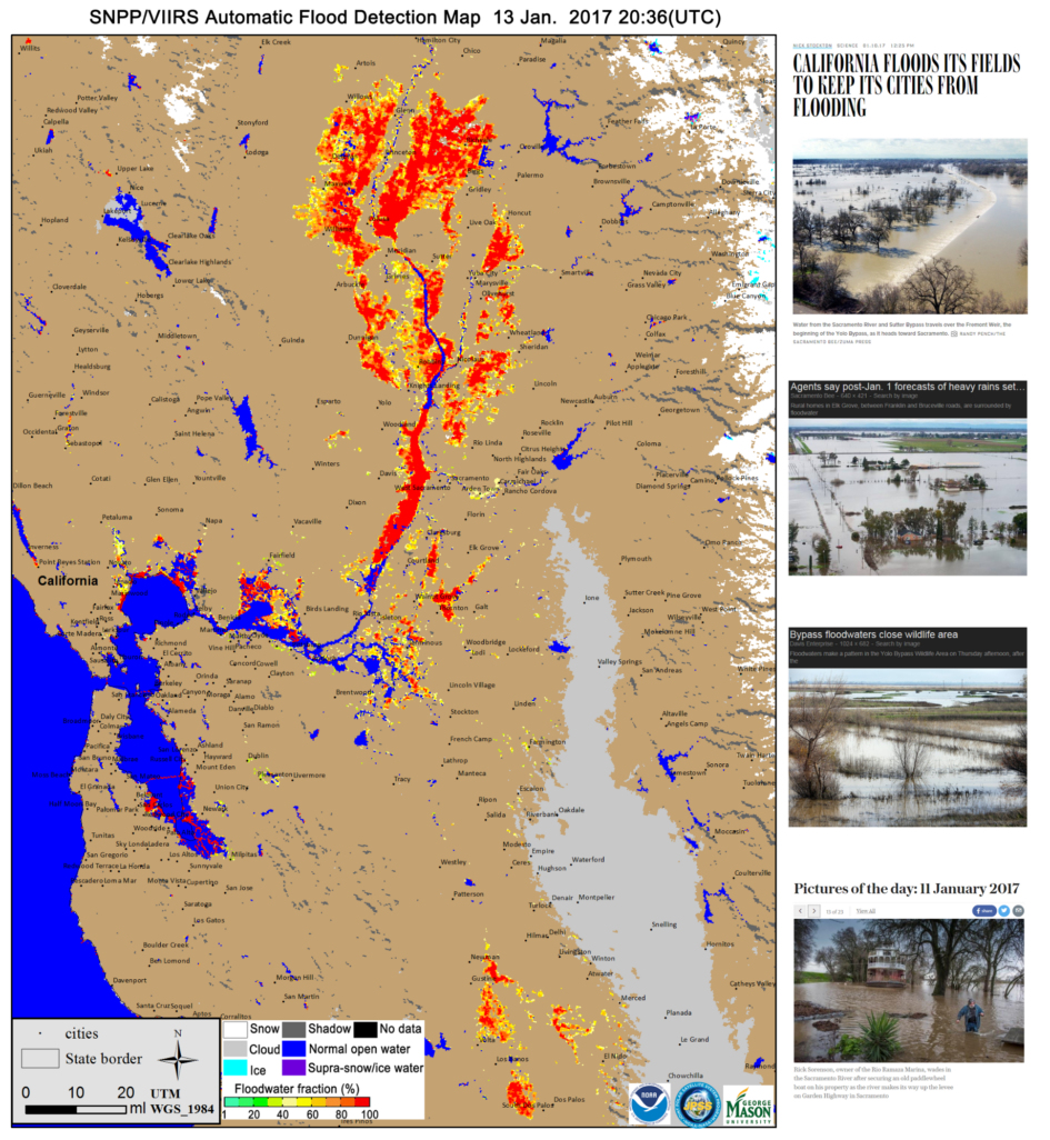
The motivation for this research dates to 2013 when Galena, Alaska experienced severe flooding. There was a lack of local data to monitor flooding, so the use of polar-orbiting satellite observations using direct broadcast data allowed for routine flood detection, which assisted river forecasters in the area. After this success, the project expanded to other locations in the United States and globally.
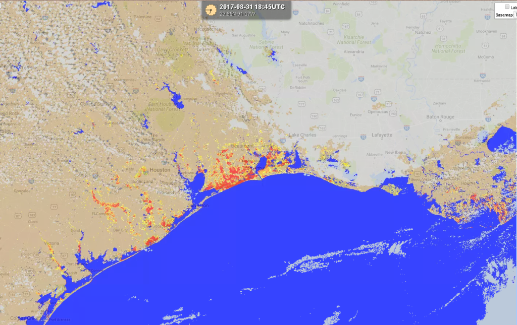
In 2017, Hurricane Harvey caused flooding that devastated Texas and Louisiana. When Harvey struck, the team’s flood products were pushed to the National Weather Service, river forecasters, and the Federal Emergency Management Agency to help determine where to send flood assessors and disaster relief. CIMSS routinely pushes the LEO/GEO flood products to FEMA to help with large scale flooding events as they occur.
These new tools are especially helpful to countries that do not have their own flood monitoring services. The International Charter Space and Major Disasters brings together national organizations like the National Oceanic and Atmospheric Administration and users to help with natural disaster monitoring and response. In 2020, for example, Hurricane Eta devastated many countries, but they were able to monitor flooding from the merged ABI/VIIRS product. Other international stakeholders, such as the World Food Programme, also download the products for their relief efforts.
The flood monitoring products are available on SSEC’s RealEarth. Daily and five-day composite products are now available.
Recently, the VIIRS Flood product was transitioned to operations with the NWS. The efforts at CIMSS “continue to be the bridge between research and operations as these products evolve,” says Hoffman.
This work was supported by the JPSS Proving Ground and NOAA.