Sneak preview of TROPICS mission with rare pathfinder launch
This summer University of Wisconsin–Madison Space Science and Engineering Center researchers leading the Time-Resolved Observations of Precipitation structure and storm Intensity with a Constellation of Smallsats (TROPICS) investigation will get a sneak preview of their mission to study hurricane development.
NASA has currently scheduled a launch of an engineering model version of the TROPICS satellite instrument for late June 2021 by SpaceX. This rare opportunity will provide a dry run to test the capabilities of TROPICS’ six small satellites known as CubeSats ahead of the official launch in 2022.
“It’s one of the first CubeSat missions that NASA is funding. For $30 million, you get seven satellites with state-of-the-art instrumentation,” says Ralf Bennartz, SSEC senior scientist and principal investigator for UW–Madison’s involvement in the mission. Bennartz is also a professor of Earth and Environmental Sciences at Vanderbilt University.
Most remote sensing satellites currently in orbit, like the Joint Polar Satellite System and Suomi National Polar-orbiting Partnership from the National Oceanic and Atmospheric Administration, are the size of a school bus. In contrast, the much smaller CubeSats are about the size of a shoebox. However, as Bennartz notes, their performance is expected to be similar to their much larger and more expensive satellites counterparts.
One of the keys to studying tropical cyclones is high temporal resolution data and imagery – that is, very frequent or continuous observations in order to closely monitor changes in the evolution of a tropical storm. For this research, scientists typically use geostationary orbiting satellites because they fly in a fixed location above the Earth, thereby providing the necessary high temporal resolution. TROPICS will instead operate in three orbital planes that are non-sun synchronous but with a focus on the tropics region. However, the number of satellites in the mission constellation will allow scientists to gather measurements of tropical cyclones roughly every 90 minutes, compared to 6 hours for today’s operational low-earth orbiting satellites.
“That’s not your standard orbit,” says Bennartz of the non-sun synchronous orbit. And so finding a launch partner would take some time. With that in mind, NASA agreed to launch the engineering model into a more typical polar orbit to help the team test their observational and data processing approach. Working with real data will allow them to assess data quality, and by extension, the quality of the algorithms that they’ve developed. The instrument will be making measurements in parts of the spectrum that have not been used before in previous research or operational missions.
“Since everything is so novel, we don’t have any direct heritage for the instrument; we don’t have any direct heritage for the observations. Everything is built on simulations and very few aircraft observations. So the pathfinder satellite that is being launched will allow us to test all our algorithms on real data to see if there might be any issues that we could take care of before the main constellation is launched,” says Bennartz.
The science of TROPICS
Part of what makes this mission so novel is what also makes it possible–in particular, being able to shrink the spacecraft down to the size of a shoebox.
“We’re going to be exploring some unique frequencies in the microwave that haven’t been used or tested before in meteorological applications. These are higher frequencies, which means we can have a smaller signal receiving dish on the satellite,” says Chris Velden, a TROPICS co-investigator and SSEC senior scientist.
These new frequencies they’ll be studying are very similar in principle to ones currently used on large operational satellites that provide atmospheric temperature and moisture profile information, explains Velden. They plan to use these data to examine tropical cyclone warm cores, and in particular some observed temperature anomalies to better understand their characteristics and impact on the evolution of the storm.
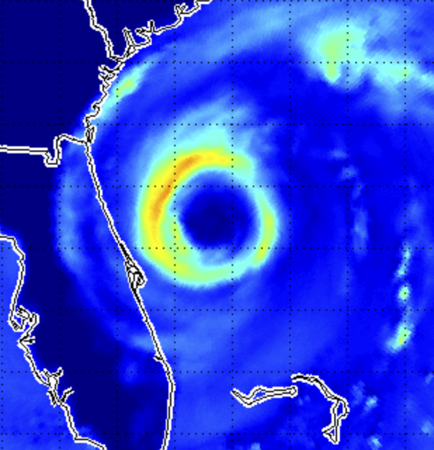
“We’re going to focus on this upper-tropospheric warm thermal anomaly in the storm core, which relates to the intensity and the structure. And hopefully we’ll be able to deduce whether our algorithms that currently work with the NOAA satellites can work just as well with these new frequencies,” says Velden.
SSEC’s Derrick Herndon, also a TROPICS Co-I, has been updating their existing algorithms that estimate a storm’s maximum surface winds and minimum sea level pressure from satellite-depicted warm core anomaly magnitude, to modify them to work with the new TROPICS frequencies. In addition to demonstrating the ability to use different microwave bands for their research, the team will help determine whether smaller and less-expensive CubeSats can play a role in the future of operational satellites.
Consequently, another key piece to this research is studying the impact of these new microwave data on numerical weather prediction model forecasts. While SSEC’s Tom Greenwald is working with Bennartz to produce microwave retrievals of temperature and moisture from the radiances to investigate hurricane intensity, Bennartz has also been conducting brightness temperature simulations. Observed brightness temperatures are important for data assimilation. And while the simulations have shown positive impact in numerical weather prediction forecast models, real data from TROPICS will bolster their case for improvements in hurricane intensity and track forecasting.
Processing the data
Long before this first launch, the TROPICS Data Processing Center based at SSEC has been preparing for the flow of data. One of the first steps is accepting the delivery of the science algorithms from the TROPICS science teams and integrating them into their data processing system, explains Jessica Braun, project manager of the TROPICS DPC. While the science teams ensure that their algorithms meet the requirements to be integrated, the DPC ensures that the processing will include any ancillary data necessary for the algorithms to run. Over the course of the mission, as they gain more experience with the data, the scientists will adjust their algorithms and provide updates to the DPC.
After launch the DPC will have two main areas of responsibility: processing TROPICS data as it comes in from Blue Canyon Technologies as part of the continuous forward stream and reprocessing data as needed and requested by the science team members. Blue Canyon is managing the ground system portion of the mission; the DPC has been working closely with them to test connections and ensure the flow of data. Similarly, the DPC has been preparing to deliver data to Goddard Earth Sciences Data and Information Services Center, which will serve as the data archive for the mission.
The DPC will also have a website to allow team scientists to examine the data during the mission – by browsing imagery and being able to choose which data to download. For example, using this site, a scientist can determine which CubeSat(s) would have observations of a specific tropical cyclone or even what other satellites overlap with these CubeSat measurements for comparisons, allowing them to focus their data search.
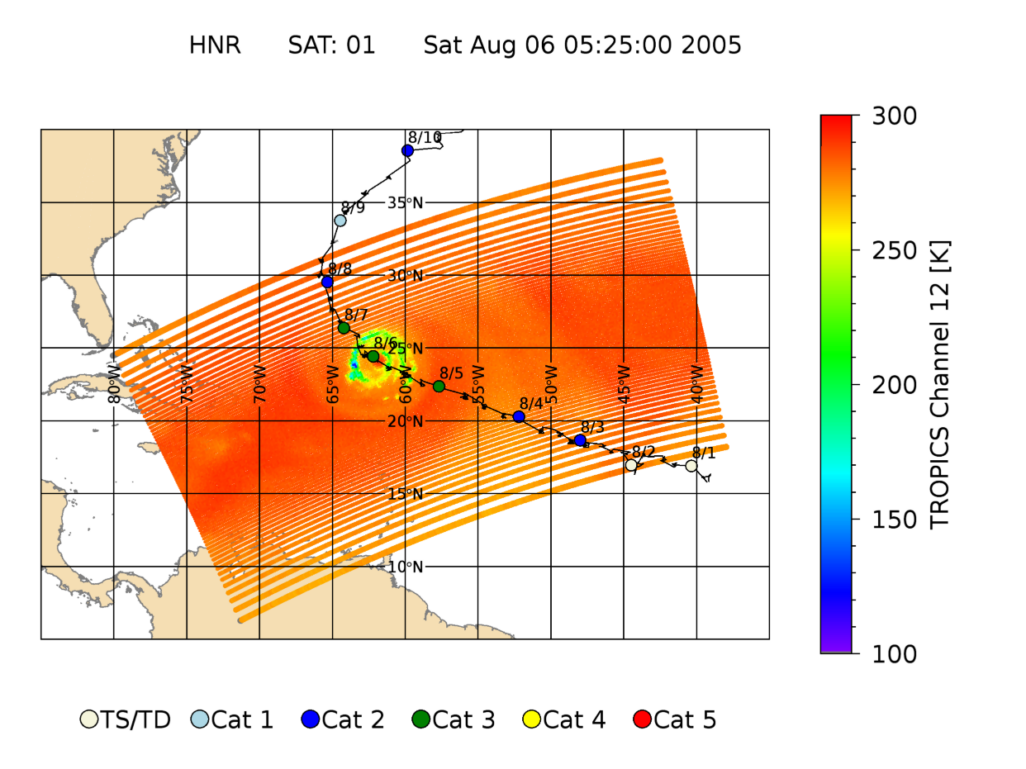
Credit: Ralf Bennartz and Zhenglong Li
Braun says that she and the rest of the DPC team are eager to begin working with real data – and feeling fortunate that will happen months before they originally expected to receive data from any of the six satellites.
“To be able to get it earlier is really great for us, so that come constellation mission, it should be a much smoother process. And hopefully, we can get data out to the public much sooner,” says Braun.
Working behind the scenes on the details of the processing system, SSEC’s Zach Griffith and Kevin Hrpcek have been the two main developers for the DPC. Their work has benefited from SSEC’s long history of data processing experience and success, most recently with the Suomi NPP Atmosphere Science Investigator-led Processing Systems and prior to that with the NPP Atmosphere Product and Evaluation and Test Elements. The SIPS and PEATE showcased SSEC’s ability to create the infrastructure and expertise necessary to ingest and process satellite datasets in a timely fashion, which the TROPICS DPC is now leveraging.
Developing that expertise and preparing for a science mission such as TROPICS often takes years. Bennartz notes that he and Dr. William Blackwell of the Massachusetts Institute of Technology’s Lincoln Laboratory, who is the overall TROPICS PI, have been working together for more than 10 years to develop the science concepts, as well as the plans to get the observations that they’ll need to continue their research.
It won’t be long now before they’ll see the first of seven satellites launch into space, followed by the data that they expect will add to our knowledge about tropical cyclones, and most importantly, improve our ability to accurately forecast them – saving lives and property in the process.