High-altitude science
The National Oceanic and Atmospheric Administration has awarded the University of Wisconsin–Madison Space Science and Engineering Center $1.2 million for the development and testing of the next generation Scanning-High Resolution Interferometer Sounder, or S-HIS. Developed at SSEC, the S-HIS is a remote sensing instrument that makes precision measurements of key atmospheric variables important for weather and climate research.
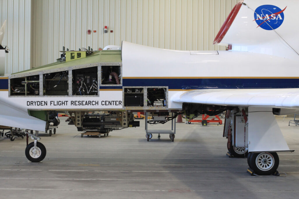
SSEC engineers and scientists first designed the S-HIS as a compact instrument mounted underneath the wings of high-altitude aircraft. Its compactness allows for testing and refining the instrument on Earth with an eye towards adapting it for future spaceflight missions. Traditional weather satellites are packed with earth-observing instruments that provide meteorologists 24/7 data to monitor the atmosphere and predict severe weather. One drawback however, is that it is difficult, if not impossible, to service those instruments if they malfunction after launch.
“For more than two decades we’ve flown the S-HIS on board these high-altitude aircraft as a way to develop new instrument technologies,” says Joe Taylor, SSEC scientist and principal investigator. “These remote sensing measurements act as a bridge to in situ measurements and you have the flexibility to look at specific cases.”
The instrument is designed to measure infrared radiation in the atmosphere. Earth’s surface and air radiate energy across the electromagnetic spectrum, but certain features, like clouds or water vapor, absorb and reflect energy in the infrared. These measurements yield useful information about the formation of hurricanes, tornadoes, floods and other severe weather.
Credit: Joe Taylor
Satellites offer unprecedented views of changing atmospheric conditions from a vantage point of 800 km (500 mi) to more than 36,000 km (22,000 mi) away from Earth; however, given the construction costs and build times, each of these satellites must undergo rigorous testing before launch to ensure their payloads and systems are ready for orbit.
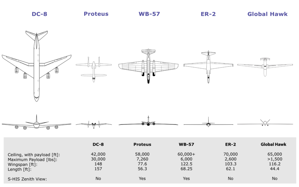
In contrast, high-altitude aircraft such as NASA’s ER-2 and NOAA’s WB-57 provide a unique platform to test new remote sensing technologies for future satellite missions. Once in flight, these aircraft can mimic the vantage points seen by satellites from orbit. An important difference; however, is that once the planes land, the instruments can be refined or repaired.
By comparing atmospheric data collected on the ground such as temperature, humidity and water vapor to S-HIS data gathered from the air, researchers are able to calibrate space-bound detectors to ensure their accuracy in orbit. This also includes validation of data from satellites already in orbit such as GOES-16, GOES-17, and the latest GOES-18 which launched in March 2022.
“This is how scientific instruments are developed – over time and with ingenuity and continuous improvements,” says Taylor. “Each step allows us to envision new uses and this is an exciting aspect of our work.”
This work is supported by SSEC and NOAA.