Preserving satellite history
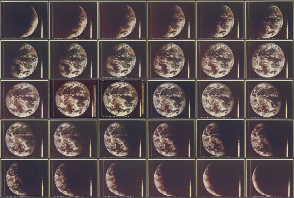
When NASA’s Applications Technology Satellite 1 launched in 1966, it made history by sending back some of the first geostationary images of our planet. The premise was simple, “the weather moves, not the satellite.”
That was the vision of University of Wisconsin-Madison’s Dr. Verner Suomi who helped usher in a new era of atmospheric and Earth science through his vision of studying Earth from space.
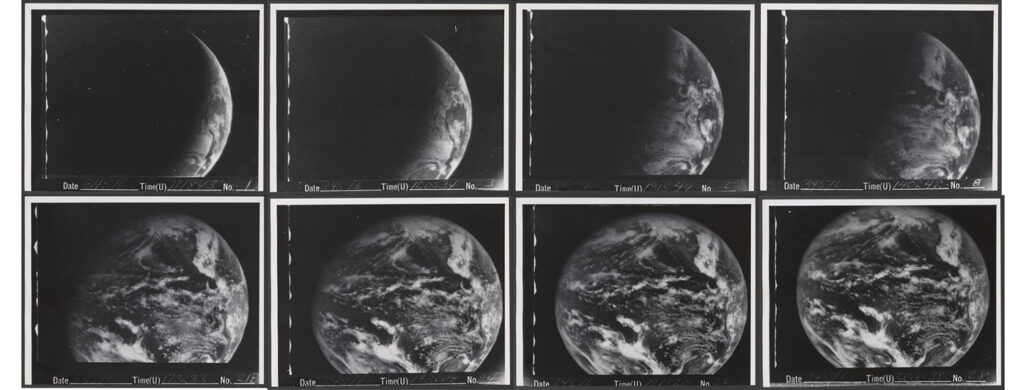
An ongoing project to digitize those early images is happening at UW-Madison Space Science and Engineering Center and Cooperative Institute for Meteorological Satellite Studies. The catalogue spans eight years from 1966 to 1974 when ATS-I and its successor ATS-III were operating. The collection totals more than 66,000 images.
Highlights include:
- First satellite images of Earth from ATS-I, December 11, 1966
- First color video of Earth from ATS-III
- First Earth Day captured by ATS-III April 22, 1970
- Hurricane Camille August 17, 1969, the costliest hurricane to hit the U.S.
- Super tornado outbreak April 3-4, 1974 from ATS-III
- Hurricane Agnes June 14-24 from ATS-III
- Thanksgiving snowstorm, November 24, 1971
- SSEC co-founder Dr. Verner Suomi explaining how geostationary satellites work
According to NOAA Scientist Tim Schmit, the digitalization of the ATS visible geostationary images is a critical first step toward tapping into the potential scientific uses of the data.
Credit: SSEC and NASA
“In addition to image and loop generation for these extreme weather events, these data can be used for generating re-analysis of past weather and can be used for investigating hurricanes pre-dating the modern satellite era,” says Schmit. “Other uses could be extending cloud climatology further into the past and possibly generating cloud-drift atmospheric vector winds.”
SSEC’s Satellite Data Services is currently working to correctly identify times and dates of the images, as well as adding geo-location, so they can be used to study historic weather and climate patterns.
This work is supported by SSEC and the University of Wisconsin Digital Collections