The Making of Real-time Volcanic Cloud Alerts
In April of 2010 millions of airline passengers across Europe were bumped from their flights because of the Eyjafjallajökull volcanic eruption in Iceland. The ash cloud that spewed from the volcano reached jet cruising altitudes within busy North Atlantic and European air routes. The majority of air traffic in this region was grounded to prevent jet aircraft engines from being damaged or disabled by the ash clouds.
Mike Pavolonis, a National Oceanic and Atmospheric Administration (NOAA) researcher working at the UW-Madison Cooperative Institute of Meteorological Satellite Studies (CIMSS), has created a unique set of mathematical equations to plot and analyze atmospheric ash clouds from volcanic eruptions.

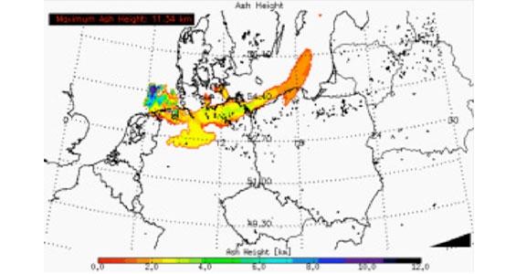
Results from the automated next generation Geostationary Operational Environmental Satellite (GOES-R) volcanic ash detection and retrieval system are shown for ash clouds produced by eruptions of Eyjafjallajökull, Iceland on 15 April 2010. The image shows the ash cloud over Germany, the Czech Republic, and Poland on 16 April 2010 at 18:30 UTC.
“Different eruptions produce different types of clouds,” Pavolonis says. “Some are easier to distinguish than others. We look at the different wavelengths and how the cloud evolves in time.”
There are three main categories of volcanic clouds: semi-transparent ash-dominated clouds, opaque volcanic clouds, and SO2 clouds.
Semi-transparent ash-dominated clouds
Primarily composed of volcanic ash particles, this type of volcanic cloud is semi-transparent to infrared radiation. Clouds of this variety are very common and, as such, regularly (e.g. daily) impact aviation to some degree. A combination of radiative transfer theory, a naïve Bayesian statistical model, and image processing techniques (cloud object analysis) are used to detect volcanic ash clouds with skill comparable to that of a trained human analyst.

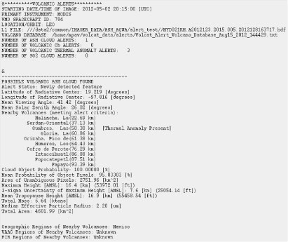
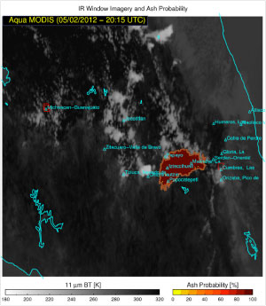
Automatically generated output from the GOES-R volcanic cloud alert system is shown above for a 02 May 2012 eruption of Popocatepetl in Mexico. An image showing the ash probability overlaid on an infrared image is shown, along with the text alert, complete with a summary of the ash cloud properties.
Opaque volcanic clouds (volcanically initiated convection)
These clouds are mostly observed as a result of a major eruption and have caused in-air engine failures so early detection is critical. Early detection, however, is difficult because the cloud can easily be mistaken for meteorological convection (e.g., a thunderstorm). Lightning is often present in these clouds, but its presence is not sufficiently unique to differentiate it from meteorological convection.
SO2 clouds
Composed of sulfur dioxide (SO2 gas), this type of cloud is invisible to the naked eye, but it is still regarded as an aviation hazard, especially in large concentrations. Some eruptions produce large amounts of SO2 and very little ash and vice-versa. SO2 absorbs and reflects detectable amounts of radiation only at select wavelengths.
“A computer algorithm to search satellite data for volcanic clouds is very difficult to do,” Pavolonis says. “Difficult, but not impossible. Our goal is to make real-time volcanic cloud alerts for all volcanic cloud types available to the Volcanic Ash Advisory Centers that are responsible for issuing advisories to the public.”
To that end, Pavolonis is developing sophisticated fully automatic algorithms to extract quantitative information on ash cloud properties from satellite data in near real-time. These algorithms will also be part of the preparation for implementation and operations on the next generation satellite, GOES-R, which will be launch ready in 2015.
“We are now at a point where we have a prototype system that is ready for testing in operations,” Pavolonis says. “Soon we will begin testing the complete automated alert system in real-time using current satellite technologies such as MODIS, VIIRS, GOES, and SEVIRI. And with the next generation of satellites we are going to obtain images more frequently, and in more wavelengths. We will be detecting these dangerous clouds in a more timely manner, and characterizing their properties more accurately.”

