Monthly News Summary – May 2009
- Gazing Into the Future: Capturing the Next Decade’s Satellite Data with Today’s Instruments
- Paul Menzel presents “CIMSS Role in GOES – Past, Present and Future”
- Atmospheric Radiation Measurement Mobile Facility Team Receives DOE Award
- Your Chance to Ride Your Bicycle (or Take a Hike) Through the Solar System
- Canadian Television to Show Redoubt Eruption Imagery
- Shelley Knuth Receives Antarctic Medal
- Sanjay Limaye Brings Venus to India
- SmartPhone Magazine recognizes PAW
- Science Expeditions Arrives at AOSS
- Student Tours Liven Up the Building
- Publications
- CIMSS Releases Direct Broadcast Package
- Energy Smart AOSS (Atmospheric, Oceanic and Space Science)
Gazing Into the Future: Capturing the Next Decade’s Satellite Data with Today’s Instruments
If everything occurs according to plan, the NOAA’s Geostationary Orbit Environmental Satellite (GOES-R) will be launched into high orbit by NOAA in 2015. By 2017 it will be fully operational, utilizing its many sophisticated instrument packages to collect and transmit data about the Earth’s atmosphere, land and oceans at speeds and resolutions far beyond the capabilities of today’s satellites. In addition, other instruments will monitor the space environment and the sun.
In previous generations of satellites, applications to use satellite data were not fully constructed and utilized until the spacecraft was actually in orbit, resulting in a “catch-up” period as scientists hurried to learn what they could do with the new technology and how to do it. This wasted valuable satellite “life-time” and resulted in a lag in productivity.
With GOES-R, however, things will be different.
Scientists from the University of Wisconsin-Madison Cooperative Institute of Meteorological Satellite Studies (CIMSS) are participating in the GOES-R Proving Ground, a project designed to bridge the gap between research and operations. This project is supported by NOAA’s GOES-R Program Office. The scientists are utilizing current systems (satellite, terrestrial, and model/synthetic) to emulate various aspects of future GOES-R capabilities. Their goal is maximum utilization of the satellite from Day One for both developers and users of GOES-R observations systems as well as an effective transition of GOES-R research products to the operational weather and environmental communities
Using knowledge and techniques acquired in the Proving Ground, forecasters and other users of the satellite’s end products will be trained before launch so that they can use all spectral bands and derived products immediately after the satellite enters routine service.
One complicating factor is that current geostationary satellites over the U.S. use five frequency bands in the visible, near-infrared and infrared range to gather data from the Earth’s atmosphere. GOES-R’s Advanced Baseline Instrument (ABI) will be observing in 16 spectral bands. How can we demonstrate its capabilities using today’s technology?
“There are two ways,” says NOAA scientist located at CIMSS Tim Schmit. “You can create proxy data using actual data from existing polar satellites. Or you can use a series of high-resolution numerical models, using carefully designed algorithms to extrapolate from current data to what the future satellite will see. We can use a situation from the past, when we had five bands to look at, and show how it will look with the 16 bands on GOES-R’s ABI.”
The GOES-R Proving Ground relies on close coordination with Algorithm Working Group (AWG) and Risk Reductions programs to provide demonstration products and enhance the operational transition pathway.
Another complicating factor is that GOES-R is required to provide up to 68 distinct products, or data streams. 35 of the 68 products are being developed by UW-Madison CIMSS/NOAA scientists. Some of these products include clouds, volcanic ash, icing, turbulence, and sulfur dioxide distribution. Not all of them can be simulated before launch. Some will need to wait for the actual ABI data transmitted from the satellite to be effective. But by 2016, when the satellite is actually in orbit, most of the data will be addressed by more sophisticated simulations – a constant process of creation, testing, and modification.
A key element of this activity is a sustained interaction between the developers and end users in order to facilitate training, product evaluation and solicitation of user feedback. Both satellite product developers and forecasters will test, apply, and evaluate algorithms to give them experience in using the GOES-R satellite data before it is even available.
Kris Bedka, another UW-Madison CIMSS researcher says, “With this ongoing Proving Ground effort at the Storm Prediction Center in Oklahoma, you aren’t in a cubby-hole focusing on your own work and products. You interact with the other groups and help others understand how satellite data can improve the thunderstorm warning process or expand the use of satellite data in computer models to better forecast thunderstorms. Everyone shares their angle on the problems.”
Benefits are already accruing in areas other than simply preparing to fully utilize the advance in technology that GOES-R represents.
The Storm Prediction Center saw a need for quicker identification of Convective Initiation, the rapid upward growth of cumulus clouds that can signify a coming severe weather event.
CIMSS researcher Wayne Feltz: “Using current GOES Imager data, we re-quantified the Convective Initiation process so we could signal that initiation was occurring. The Proving Ground gave us the opportunity not just to develop the algorithms, not just to do basic research into the algorithms, but to incrementally improve the product by working with the end users. We’ve actually designed new applications, like Convective Initiation, that have never really existed before, in anticipation of ABI. We’ve found that we can use the data right now.”
Using the new system, the Convective Initiation that indicates severe weather can be reliably detected up to 45 minutes before radar can even see the storm.
A satellite that won’t be launched into orbit until 2015 is already paying dividends in advanced weather studies.
For more information go to:
http://cimss.ssec.wisc.edu/goes_r/proving-ground.html
http://hwt.nssl.noaa.gov/Spring_2009/
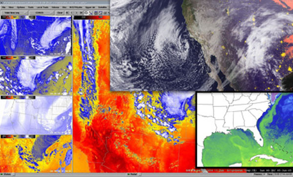
Examples of GOES-R Proving Ground images and products.
Paul Menzel presents “CIMSS Role in GOES – Past, Present and Future”
At the April 21 CIMSS Board of Directors meeting, Paul Menzel presented “CIMSS Role in GOES – Past, Present and Future,” a history of the participation of Vern Suomi, SSEC, and many others in the more than half a century of meteorological satellite studies of the Earth.
For a copy of this slide presentation, as well as his definitive historical document: “Remote Sensing Applications with Meteorological Satellites,” click here.
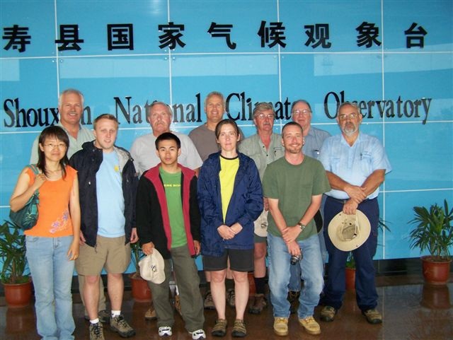
Atmospheric Radiation Measurement Mobile Facility Team Receives DOE Award
Denny Hackel was part of the Atmospheric Radiation Measurement (ARM) Mobile Facility deployment team that received a Department of Energy award at the ARM Science Team meeting for their “outstanding efforts” for the China deployment.
ARM Climate Research Facility Operations Manager Douglas Sisterson wrote to the team: “This award belongs to you as part of a great team but also individually. Everyone involved with the China deployment had to dig extra deep, think outside the box and tolerate a lot of unforeseen redirection and often stressful working conditions. Everyone played an integral part in making China a success and I personally could not wish for a better team to work with. This recognition from DOE for your efforts should be held in high regard. Awards such as this are seldom presented.”
No one from the team was present to accept the award – they were already on their way to Portugal for the next installation!
Your Chance to Ride Your Bicycle (or Take a Hike) Through the Solar System
UW-Madison’s Space Place has re-created the entire Solar System at a scale of 1-to-200-million and placed it along Madison’s Southwest Bike Path and the Military Ridge Trail. A 24-foot sun on Monona Terrace marks the beginning of Planet Trek Dane County. Tiny Pluto (recently demoted from “planetary” status, but still a sentimental favorite) can be found 23 miles away in Mount Horeb. All of the planets, including the giant asteroid Ceres, can be found at scale-accurate distances and sizes along the path.
Check out a more in-depth article at http://www.news.wisc.edu/16647. And take the Trek to get an up close and personal feel for astronomical scale.
Canadian Television to Show Redoubt Eruption Imagery
The French Canadian Broadcasting Corporation will use this animated loop of the volcanic ash cloud bursting from Mount Redoubt in Alaska in a one-hour science program to be aired this fall. Scott Bachmeier provided the footage (captured by MTSAT on 26 March 2009) to be part of a program focusing on volcanic ash, aviation safety and activities of the Montreal Volcanic Ash Advisory Centre.
http://cimss.ssec.wisc.edu/goes/blog/wp-content/uploads/2009/03/090326_mtsat_vis_anim.gif
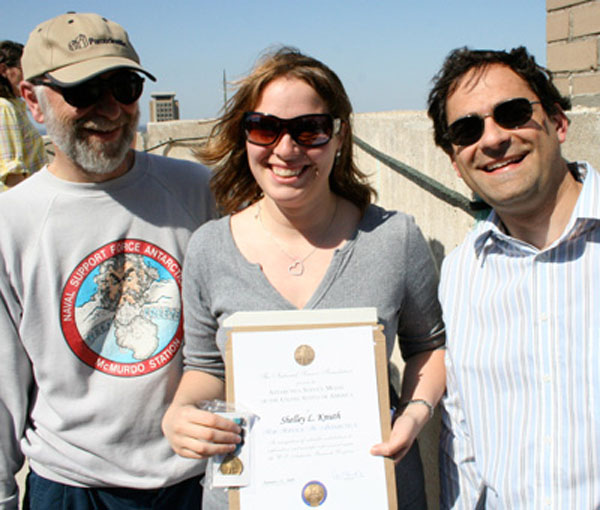
Shelley Knuth Receives Antarctic Medal
The National Science Foundation presented the Antarctica Service Medal to Shelley Knuth. The medal is awarded to members of Antarctic expeditions and personnel of the permanent Antarctica stations or for service in contiguous waters. It is awarded to officers and enlisted men of the armed forces and to deserving civilians, such as scientists and polar experts. A minimum period of 30 days of service at sea or ashore south of 60 degrees latitude is required.
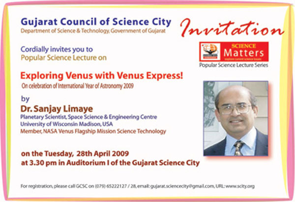
Sanjay Limaye Brings Venus to India
On 28 April 2009 Sanjay Limaye presented his lecture “Exploring Venus with Venus Express” at Gujarat Science City, the new education and entertainment complex at Ahmedabad, India, as a part of the popular science lecture series “Science Matters.” The series deals with topics on frontier areas of science and technology to spread new knowledge and awareness among the students as well as the public at large. This particular lecture was a part of the International Year of Astronomy 2009.
The talk described what we have learned from the past missions to Venus and key findings from Venus Express, as well as summarizing future missions.
SmartPhone Magazine recognizes PAW
Russ Dengel’s PDA Animated Weather service (PAW) got a nice notice in SmartphoneMag.com. Link here: http://www.smartphonemag.com/cms/blog/414/paws-weather-site-adds-uscanadian-radar-composite
The article includes a link (http://www.ssec.wisc.edu/data/paw/index.html) to the PAW Home Page. PAW is a PDA friendly weather web site that contains real-time images, graphics and text formatted for display on PDA devices equipped with high-resolution color displays.
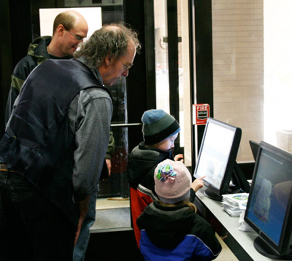
Science Expeditions Arrives at AOSS
On Saturday, 04 April 2009, the University of Wisconsin-Madison hosted Science Expeditions, a campus-wide open house promoting science and technology. Between 100 – 200 people visited AOSS to learn about different applications of remote sensing technology from many engaging displays and activities.
Tom Whittaker helped kids “Explore the Atmosphere” with a set of computer applets that teach the basics of atmospheric science.
Bob Aune (NESDIS/STAR) and Jordan Gerth (CIMSS) gave presentations on applications of satellite data in forecasting and numerical weather prediction. Jordan demonstrated how satellite observations are used in the National Weather Service’s Advanced Weather Information Processing System (AWIPS).
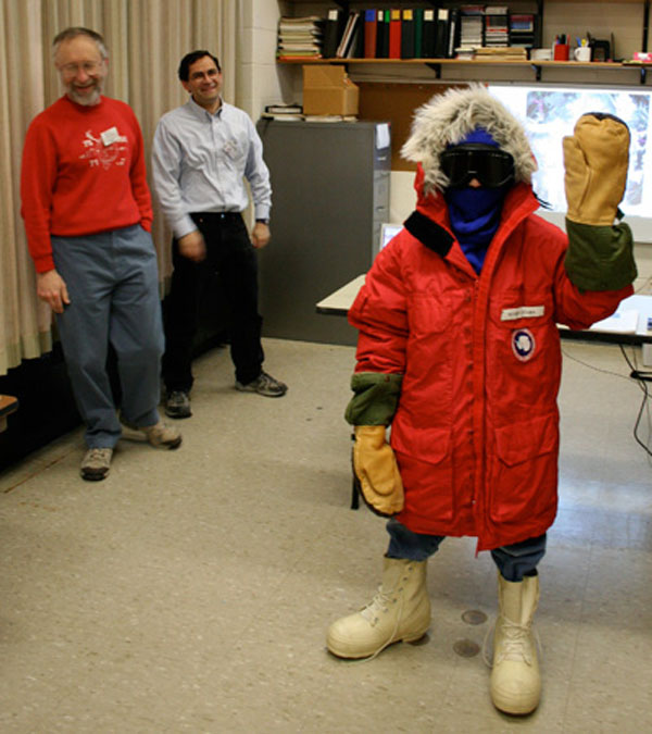
Matthew Lazzara and George Weidner (with lots of help from Noah, our trusty Polar Guide) took visitors on a quick tour of Antarctica.
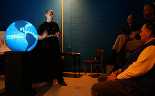
Rick Kohrs and Margaret Mooney ran the 3-D Globe, demonstrating satellite technology and orbital paths, weather patterns, sea surface temperatures and hurricane tracking, as well as a brief tour of the Solar System.
And everyone got to marvel at the view from the roof while learning about the many instruments there and SSEC’s role in the development of satellite meteorology.
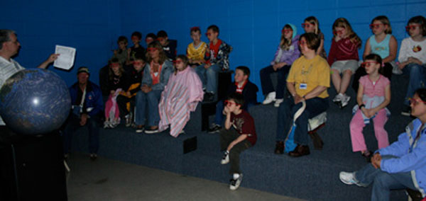
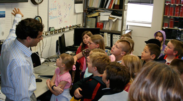
Student Tours Liven Up the Building
If you heard a lot of ruckus in the hallways several days in May it was probably the eight groups of second-graders (from Lodi and Spruce Street elementaries) and seventh-graders (from Princeton Middle School).
The students were treated to presentations on the 3-D globe by Margaret, a quick tour of Antarctica by Matthew and Shelley, and a trip to the roof.
Judging by the excitement factor, the kids uniformly had a great time. One lad, Jason, told me personally that it was “the best day of his life.”
It doesn’t get any better than that. Thanks to all for welcoming the scientists of the future.
Paper on Atmospheric Motion Vectors Accepted in JAMC: A manuscript entitled “Identifying the Uncertainty in Determining Satellite-Derived Atmospheric Motion Vector Height Attribution” by Christopher Velden and Kristopher Bedka has been accepted for publication in the March issue of the Journal of Applied Meteorology and Climatology.
Manuscript accepted in Monthly Weather Review: A paper submitted to Monthly Weather Review entitled “Impact of Satellite-Derived Rapid-Scan Wind Observations on Numerical Model Forecasts of Hurricane Katrina” has been accepted and will appear in a summer issue. The lead author is Dr. Rolf Langland of the Naval Research Lab, with co-authors Chris Velden and Howard Berger (Cooperative Institute for Meteorological Satellite Studies).
Manuscript accepted in the Journal of Atmospheric and Oceanic Technology: “A Quantum Cascade Laser Based Reflectometer for On-orbit Blackbody Cavity Monitoring” has been accepted to the Journal of Atmospheric and Oceanic Technology. The authors are Jonathan Gero (SSEC), John Dykema (Harvard University) and James Anderson (Harvard University).
Article published in Science magazine: “The Role of Aerosols in the Evolution of Tropical North Atlantic Ocean Temperature Anomalies” by Amato Evan, Dan Vimont, Andy Heidinger, Jim Kossin, and Ralf Bennartz was published in the 08 May 2009 edition of Science magazine.
Article: http://www.sciencemag.org/cgi/reprint/324/5928/778.pdf
Abstract: http://www.sciencemag.org/cgi/content/abstract/1167404
Article published in “Geophysical Research Letters and selected as American Geophysical Union Journal Highlight: “Vortex circulation on Venus: Dynamical similarities with terrestrial hurricanes” by Sanjay Limaye, Jim Kossin, Christopher Rozoff, Giuseppe Piccioni, Dmitry Titov and Wojciech Markiewcz was published 25 February 2009. In addition, the cover graphic for the journal was reproduced and supplied to NASA’s Christopher Scolese for his recent presentation to Congress regarding the NASA budget.
CIMSS Releases Direct Broadcast Package
Recently, CIMSS released a Direct Broadcast package for the International Polar Orbiter Processing Package (IPOPP) which runs under Windows XP using a virtual technology. This is a significant technology advancement as many of the application users are Windows users. Liam Gumley released a Direct Broadcast Google Earth version which allows the user to create MODIS true color imagery in a format which is compatible with the Google Earth geobrowser.
The International MODIS/AIRS Processing Package (IMAPP) and IPOPP are having impacts in several areas. Wayne Feltz held in-depth discussions with FAA directors at the AMS Convention in January concerning the federal agency’s aligning with CIMSS to support NextGen 4-D cube weather information. They have resources (funding) that may provide the ability to port the aviation work into DB/IMAPP/IPOPP package(s).
The DB activity at UW-Madison (CIMSS) has been very productive. The AIRS product has been released to NESDIS/STAR and further disseminated to NCEP and then GMAO and SPoRT for weather forecast purposes. The DB MODIS products are disseminated to many NWS Central Region Weather Forecast Offices (WFOs). Last July, CIMSS marked two years of real time MODIS data provided to NWS Advance Weather Information Processing System (AWIPS).
Energy Smart AOSS (Atmospheric, Oceanic and Space Science)
In 2008 a group of energy conscious individuals began meeting to strategize how to collectively reduce the carbon footprint of buildings on the UW-Madison campus. Comprised primarily of staff from the Atmospheric, Oceanic and Space Science building, the committee soon decided to focus on AOSS and create a campus-wide model for “Energy Smart Buildings” in close collaboration with Facilities Planning & Management (FP&M) and We Conserve, culminating in a building-wide energy awareness campaign in April 2009.
The emerging model for Energy Smart Buildings begins with HVAC – Heating Cooling & Air Conditioning, because HVAC accounts for 72% of the electricity consumed by most campus buildings and 50% of electricity used at AOSS.
FP&M monitored the HVAC at AOSS and found that air was being exchanged nearly 3 times more often than recommended for public buildings, wasting energy and causing discomfort for most occupants. Not only were we wasting energy by moving too much air in and out of the building, we were wasting energy conditioning all that excess air! As a result of this study, FP&M eased AOSS air circulation to 75% of the previous turn-over rate and 30% during unoccupied times (overnight and Sundays), an adjustment estimated to reduce AOSS electricity consumption by 18% annually.
FP&M also conducted a lighting study at AOSS and identified annual savings of 416,000 kWh through upgrades which will include swapping out current fixtures and fluorescents with new T-8 5000K energy efficient lighting.
Harvesting low hanging fruit through HVAC adjustments and lighting upgrades will clearly result in significant reductions to the carbon footprint at AOSS by decreasing waste. Greater challenges reside in addressing computer inefficiencies, computer purchasing practices, commuter choices and individual work habits such as the simple choice to print less, set defaults to two-sided printing, disable screen savers or turn off lights when rooms are unoccupied. This is why the model for an Energy Smart Building includes an educational component.
The energy awareness campaign at AOSS began with information and coffee in the lobby during Earth week. Volunteers created informative posters and staffed a table each morning, inviting building occupants to bring a mug, enjoy a free cup of coffee and discuss energy conservation topics. Perhaps the most enlightening bit of building education was HVAC basics and the fact that air is cooled to 55o to wring out the humidity before being circulated to individual offices. This means that turning thermostats down when rooms are unoccupied saves energy year-round.
Also during Earth week the AOSS Schweredtfeger Library established the first campus kWh meter lending program enabling UW staff and students to borrow meters that measure energy consumed by office equipment and home appliances.
As one committee member aptly quipped “if not us -who?” It is only appropriate that AOSS and FP&M should partner in energy conservation efforts and that AOSS would play a leading role to identify and implement initiatives that reduce the carbon footprint of a single campus building while creating a model for other UW buildings to follow.
For energy saving tips and more information about energy awareness efforts at AOSS please visit http://www.ssec.wisc.edu/energy/
— submitted by Margaret Mooney