Monthly News Summary – November 2008
- Lake Delton Draining Illustrates Value of Imagery Access
- And More From WisconsinView
- “Cold Digger” — Charlie Bentley
- New Alpha Version of McIDAS-V Now Available
- Remote Sensing Course Taught in Sardinia by CIMSS
- SSEC International Workshops Highlighted
- Chris Velden Elected to Membership in the New International THORPEX DAOS WG
- 3D Globe Debuts at Children’s Museum
Lake Delton Draining Illustrates Value of Imagery Access
Wisconsinview.org makes available dramatic before-and-after shots of the draining of Lake Delton. Images gathered annually by the National Agriculture Imagery Program (NAIP) of the US Department of Agriculture during growing seasons are used to monitor the health and status of crops and agricultural land use. This year, however, a far more dramatic change was captured. Not long after record-setting June floods in central and southern Wisconsin the swollen waters of Lake Delton, a man-made reservoir, burst through and around its dam, emptying the lake in a matter of minutes. The first photograph was taken at a 2-meter resolution in 2006; the second with a 1-meter resolution in 2008 (this year’s imagery was captured by aircraft in July and August).
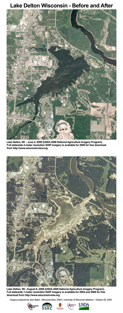
The imagery is striking because of the detail, the clear change-over-time and the timeliness of the story. It is only because of the new availability of 2008 NAIP imagery at WisconsinView.org that this comparison could be made so soon after the event. Alternatively, the imagery can be acquired from the USDA (@ $50 per county, per year-set — $100 for these images) through the mail, but it would take some time to get it. Wisconsinview.org supplies them immediately and at no cost.
The 2008 comprehensive aerial photography of Wisconsin (available for free download at http://www.wisconsinview.org) captures dramatic changes that occurred in the landscape since the last similar imagery collection of 2006. The imagery has a spatial resolution of either 1- or 2-meters per pixel. It is “orthorectified” or geographically corrected to mapping standards that allow it to be used for quantifying distances and areas. Evidence of the flooding and related events, such as the sudden draining of Lake Delton, are clearly visible.
Click here for the (dated) technical details of NAIP.
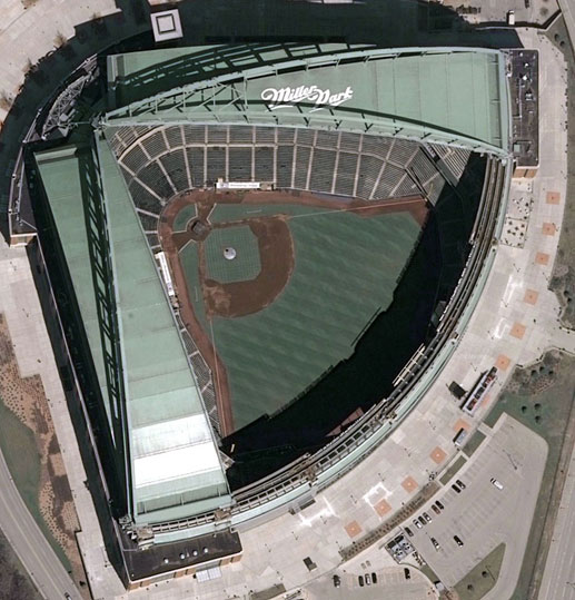
SSEC now has 1-foot resolution 2007 color GeoTIFFs of Milwaukee online at www.wisconsinview.org. The picture below is Miller Park — a small portion of one tile) to accompany imagery of Madison, Racine, and Kenosha and other imagery that has been online since 2005.
To Download from Wisconsinview.org:
- Click on “Imagery & Data Downloads”
- Use your existing login or create a new login
- Click on the “USGS Urban” tab at the far right
- Select the collection by clicking on the highlighted area on the map of Wisconsin
- Browse the close-up maps and tile grid to identify tiles to download
- Click in a white tile grid square to download a .zip file containing the imagery and associated files.
To open these images once unzipped, we recommend Photoshop or similar graphics programs. The built-in Microsoft image viewer cannot handle the “geotags” in the TIF header and skews the image.
These images come courtesy of the USGS, SEWRPC and WisconsinView. There are 385 zipped tiles in the collection that average 134MB in size but range from 15MB to 167MB depending on the imagery content and zip compression. Uncompressed the GeoTIFF files are often close to 300MB.
This data set joins the 2007 imagery (757 tiles) and the 2005 Racine/Kenosha imagery (924 tiles) that is already online. 1-foot 2005 imagery covering an area from Fon du Lac to Green Bay is in preparation (2,263 tiles) and will go online in the next month.
— Author, Organization
“Cold Digger” — Charlie Bentley
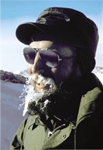
Charlie Bentley, a fifty-year veteran of Antarctic studies and an emeritus UW professor of geophysics, was celebrated in an article in the Wisconsin Alumni Online Newsletter. To read the complete article, click here.
New Alpha Version of McIDAS-V Now Available
The newest version of McIDAS-V, version 1.0alpha12, is now available for free download from the McIDAS Website – http://www.ssec.wisc.edu/mcidas/software/v
If you’re new to McIDAS-V, the training materials from the January workshop held here at SSEC are available at the bottom of the McIDAS-V Software page. The “Getting Started” chapter in the User’s Guide will also help to guide you through using the different types of data available with McIDAS-V.
For current McIDAS-V users, the most notable changes since 1.0alpha10 are the addition of more local image servers to the Local Data Manager and increased functionality to the ADDE Server Manager. A list of the additional local servers is located on the McIDAS-V download page.
The support form in McIDAS-V versions 1.0alpha10 was not working properly, and any email sent through this form to the McIDAS Help Desk was not received. This has been fixed in version 1.0alpha12. If you have not received a reply to an email, please resend using version 1.0alpha12.
We’re always looking for user feedback, so if you see something that’s not working correctly or some functionality that you’d like to see added, please send a support request to McIDAS-V Support or use the Support Request Form in the Help menu of McIDAS-V.
Would you like to provide input into the development of McIDAS-V?
Occasionally when we’re trying to decide how some piece of McIDAS-V should function, we’ll solicit feedback from the McIDAS-V group by sending out screen shots with the available options or by scheduling short meetings to discuss the options. Also, approximately once per month, we have McIDAS-V Team meetings where the developers demonstrate what they’re working on in McIDAS-V and look for user feedback. If you’d like to be added to this McIDAS-V group, please respond to this e-mail, and we’ll be sure that you’re added to the list.
Remember — this is still an alpha version of McIDAS-V, which means that there may be bugs in the software that we have not yet found or fixed. It also means that the user interface and functionality has not yet been finalized. If you’re interested in providing input into the development of McIDAS-V, there is still time to have your voice heard!
Remote Sensing Course Taught in Sardinia by CIMSS
From 21 to 27 September, Paolo Antonelli and Paul Menzel from CIMSS, together with Jochen Kerkmann and Hans Peter Roesli from EUMETSAT, taught a seven day International Summer School on Applications with the Newest Multi-spectral Meteorological Satellites in Monteponi, Italy. The local host was Professor Alberto Marini from the University of Cagliari who arranged support from the Consorzio per l’Universita del Sulcis Iglesiente. The course covered materials on:
- Radiation and the Radiative Transfer Equation,
- Spectral signatures from Earth’s surface and atmosphere,
- High resolution sounding using infrared high resolution spectral data,
- Multi-spectral sensors for imaging,
- Microwave sounding in clouds,
- RGB image combinations for cloud and severe weather studies,
- Instrument considerations and Cal/Val.
The fifty hours of classroom work was split between lectures and laboratory exercises that emphasized investigation of high spatial resolution visible and infrared data (from MODIS and SEVIRI), high spectral resolution infrared data (from AIRS and IASI), and microwave data (from AMSU). Fifteen students attended; they were from China, Hungary, Egypt, Sudan, Ethiopia, Kenya, Libya, Tunisia, Togo, Jordan, Bahamas, and Italy. The course was a significant step in establishing a dialogue between scientists in a diverse collection of countries; it is a goal that communications and collaborations started during the course will be sustained.
SSEC International Workshops Highlighted
The UW-Madison online News has featured an article about 11 international workshops conducted by SSEC personnel over the past seven years. Mission: help anyone access and use satellite observations anywhere in the world. To see the complete article, click here.
Paolo Antonelli, the focus of the article, wants to emphasize that the training provided had its deep roots in Bill Smith’s work as CIMSS director, and that this specific effort was initiated and continued under the inspiring guidance of Paul Menzel.
Chris Velden Elected to Membership in the New International THORPEX DAOS WG
CIMSS Senior Scientist Chris Velden has been elected to the newly-formed Data Assilimation and Observing System (DAOS) Working Group, which reports directly to the World Meteorological Organization THORPEX and World Climate Research Program commissions in Geneva. Existing DA and OS WGs, which in the past have been effective towards invoking new observing systems and data assimilation strategies and tactics, have been combined to create a more synergistic collaboration. The WG will develop a consensus approach towards optimising the deployment of observational resources, and create tools to identify where and when to target regions of high model error growth with creative adaptive observation sampling strategies (including satellites).
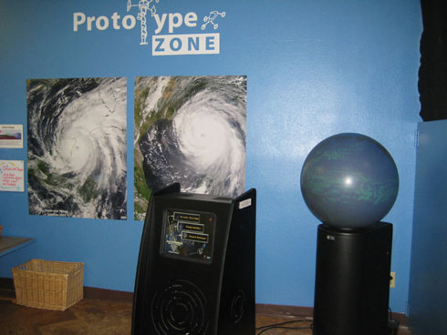
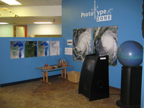
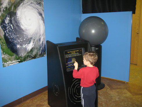
3D Globe Debuts at Children’s Museum