Satellite Imagery on Your Smart Phone – SSEC Has An App For That
In April of 2013, SSEC released its first smart-phone App designed specifically to display and animate full-resolution, real-time weather satellite data. The free App, called “WxSat” (short for Weather Satellite), delivers imagery from the SSEC Web Mapping Server (WMS) to iOS devices such as the iPad, iPhone, and iPod-Touch.
“The Weather Sat App focuses exclusively on global composites created in the SSEC Data Center,” says Dave Parker, the programmer of the application, “which is one of the most extensive collections of real-time and archived satellite data in the world.”
Dr. Sam Batzli, the project’s Geographic Information System (GIS) expert, says, “There are many geostationary and polar orbiting weather satellites around the globe capturing observations of the earth at varying time intervals.” The team decided upon an open-source GIS system that is capable of collecting and processing geographically referenced information for use in mapping, visualization and more.
“SSEC’s Data Center has a server dedicated to Weather Sat that blends the images into hourly composites,” Batzli continues. “These composites in the visible, water vapor, and infrared ranges form the basis of the animations now available on your smartphone. With the Weather Sat App on your device, you can access the WMS and receive instant global coverage.”
Jerry Robaidek (SSEC Data Center) and Russ Dengel generate most of the composites for the WMS, while Dengel and Batzli create over 150 other products managed by the WMS.
WxSat displays and animates full-resolution, real-time weather satellite data. WxSat provides global coverage for visible, infrared, and water vapor channels.
Shortly after the introduction of the iPhone in 2007, researchers at SSEC began to explore ways to publish satellite imagery and related geospatial information in formats suitable to display by smart phones.
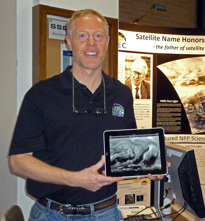
Sam Batzli demonstrates WxSat on an iPad at the UW-Madison Science Expeditions.
“The technology of browsers and mobile devices changes rapidly,” Batzli says. “We focused our efforts on building an open-source server infrastructure that could deliver content to a wide range of current and future mobile device and desktop software applications.”
The result of these efforts is the SSEC WMS, which accepts and processes meteorological, atmospheric, and land remote sensing data and imagery, both real-time and static, from a variety of satellite and sensor network sources. It converts and optimizes the data for display and interactivity in desktop software such as Google Earth, web browsers, geographic information systems (GIS), and more.
“There is a lot more capability behind the scenes of this application,” Parker says. “Capabilities that we hope to expose as the WMS project matures.”
The WxSat App is available, free of charge, from the App Store.