An Early Vision for Earth System Science Education

Donald R. Johnson. Credit: SSEC.
The Man-computer Interactive Data Access System (McIDAS), SSEC’s revolutionary software package, burst onto the scene in the early 1970s. With its introduction came an unparalleled era of visualization in satellite meteorology and an excitement about the new ability to see how the atmosphere moves over space and time.
The emergence of SSEC’s McIDAS system, the first tool of its kind to visualize satellite data, ignited discussions among Professor Don Johnson and his meteorology colleagues at UW-Madison, Frank Sechrist, Lyle Horn, Tom Whittaker and Tom Haig.
Recognizing the great teaching possibilities in using visual imagery to see and explain atmospheric properties, a team, led by Johnson, developed a plan to create a series of video-based Educational Modules for the Atmospheric Sciences – another first in meteorology. “I’ve always placed a high regard on universities, teaching and interacting with young people,” explains Johnson.
With funding from the National Science Foundation, Johnson’s team developed a new vision and method to deliver atmospheric science education. Five modules were created, each of which included a videocassette and text book, to cover the topics of:
- Squall line development (1981)
- Earth and planetary atmospheric circulations viewed from space (1982)
- Vertical temperature/moisture profiles from satellite measurements (1984)
- Cyclogenesis (1985)
- Tropical cyclones (1985)
More than 100 higher educational institutions, in the United States and abroad, purchased the modules. Faculty across the country, inspired by the productions, began generating ideas about how to broaden teaching and learning options in the discipline.
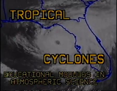
Tropical cyclones educational module. Credit: SSEC.
But creating this new way of learning through visualization was not enough – Johnson was convinced that the atmospheric sciences needed to do more to understand and convey the connections between disciplines in order to more fully comprehend the intricacies of the Earth as a system; that our ability to make good decisions could only emerge after integrating the various disciplines and broadening our view of the world.
Accepting a new role with the Universities Space Research Association (USRA) in the early 1990s, Johnson proposed that member universities get more involved in earth science education. He approached NASA to enlist support for developing a prototype earth system science curriculum involving faculty across disciplines. Impressed by the proposal, NASA, instead of funding five universities, provided initial funds for twenty enabling them to set about crafting the next generation of science, technology, engineering, and mathematics (STEM) education or Earth System Science Education 21 (ESSE 21) as it was later known. Under Johnson’s leadership and the USRA umbrella, the team developed the first Design Guide for Undergraduate Earth System Science Education.
According to Martin Ruzek, USRA colleague, “the programs enabled 63 college and university teams to develop over 130 courses…ESSE courses have reached well over 100,000 undergraduate students and most continue to be taught in one form or another.” (EOS, 2011)
With the ESSE program well-established, Johnson proceeded to develop ties with the Inter-American Institute for Global Change Research (IAI) to implement interdisciplinary courses in Earth system science and global change at Central and South American universities.
Don Johnson has been recognized for his excellence in education, receiving awards from the American Geophysical Union and the American Meteorological Society. There will be a symposium in his honor at the 2014 AMS Annual Meeting in Atlanta.
Long before massive open online courses or MOOCs and other online education options, Johnson capitalized on advances in technology, envisioning a new way of delivering earth science education that continues today.
The videocassette modules, recently converted to MP4 format, are now available on SSEC’s Schwerdtfeger Library YouTube site, along with PDF versions of the accompanying textbooks.
By Jean Phillips