Monthly News Summary – March 2008
Icebergs in Lake Michigan
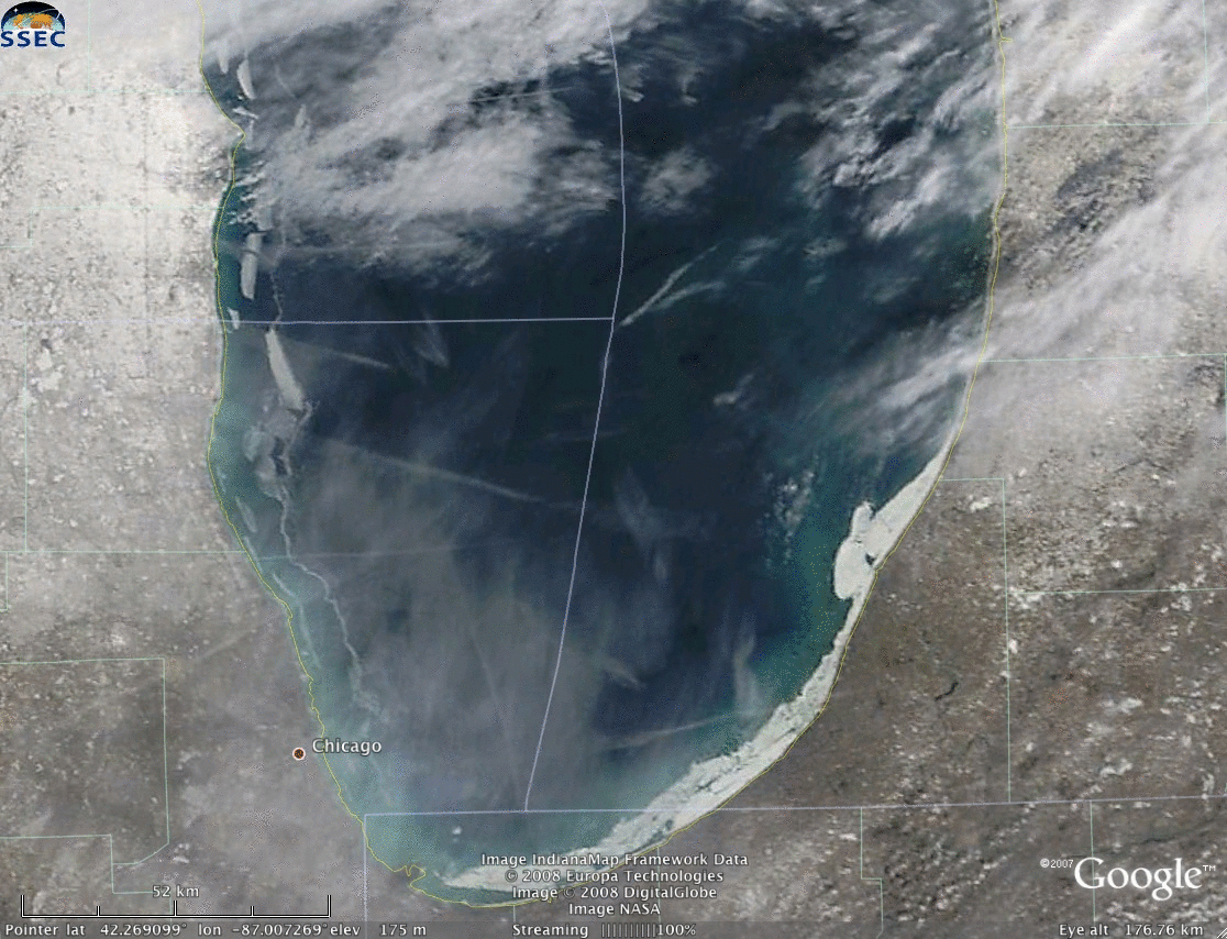
This animation depicts the ice breaking away from the southwestern shore of Lake Michigan. The streaky clouds in the image are contrails from airplanes.
They wouldn’t sink theTitanic, but the chunks of ice floating in Lake Michigan threatened smaller boats during the first weeks of March.Satellite images processed and distributed by SSEC have helped the National Weather Service draw attention to the icebergs that broke away from the Lake Michigan shoreline as winter yielded to spring.
On February 20, images from SSEC showed that the ice extended between three and eight miles from the western shore of Lake Michigan. The NWS forecast office in Milwaukee noted that pieces of the ice field began to drift away from shore on March 10, encouraged farther by winds that picked up the next day. Satellite images from March 11 show the “bergs” floating several miles from shore. By the 13th, the ice had all but disappeared.
Observations of the ice field and the subsequent bergs were facilitated by satellite images distributed to forecast offices by SSEC. The images made “Top News” at the forecast office and the Milwaukee Journal Sentinelfeatured one of the berg images from SSEC in a March 12 article about the ice.
Answering questions about atmospheric science
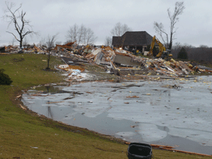
On January 7, tornadoes touched down in Wisconsin.
Every Thursday, theWisconsin State Journalfeatures a UW-Madison scientist’s answer to a question posed by a community member. In recent weeks, three SSEC scientists have provided answers to atmospheric science questions.
On January 21, Steve Ackerman explained how tornadoes form in the Midwest during January. On January 7, tornadoes touched down in southeastern Wisconsin. Ackerman said that the unseasonably high temperatures and associated evaporating snow created the necessary conditions for severe weather development. He also said that wind conditions were ideal for rotation: there was a difference in direction between the winds at lower altitudes and those at higher altitudes.

SSEC’s Data Center has many high capacity computers to carry out the complex operations necessary for metrological research.
Bob Aune (NOAA at SSEC) answered a question on February 14. Aune explained the general concept behind the supercomputers used for numerical weather prediction. The powerful computers that crunch away on atmospheric data gather power from many computer chips working alongside each other. According to Aune, the National Weather Service relies on software to divide up the complex task of modeling the atmosphere. The software then assigns each task to a processor. This division of labor allows the Weather Service to generate a forecast fast enough to be useful.
Living through one of the snowiest winters on record, snow is a popular topic of conversation among those in and around the southeast portion of Wisconsin. In the March 6 edition of the State Journal’s Curiosities column,Scott Bachmeier explained why lake-effect snow occurs. According to Bachmeier, lake-effect precipitation forms as a consequence of cold air flowing over warm lake water. While Madison does get some lake-effect snow from the area lakes, the city has nothing on the record set during the winter of 1977 in Montague, New York when 77 inches fell in 24 hours.
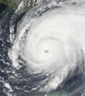
The ADT has contributed to tropical storm forecasts as a research model for many years. This spring, NOAA declared ADT fit for operational use.
Tropical storm analysis technique—The CIMSS Tropical Cyclones research team has developed and continued to improve a technique that uses infrared atmospheric data to generate a profile for a tropical storm including its strength and potential path. After several years of testing this tool, NOAA recently approved CIMSS’sAdvanced Dvorak Technique (ADT) for operational use in tropical storm prediction. CIMSS and operational forecasters at the National Hurricane Center have used the ADT as a research model for several years. Even in research mode, the information provided by the model has contributed to numerous forecast discussions over the years.
During the memorable 2005 Atlantic hurricane season, the ADT provided invaluable information about Hurricane Rita. One of reconnaissance planes experienced technical difficulties as the storm approached the coast and turned back to land. During this time, the ADT indicated a rapid intensification. CIMSS scientists noticed this intensification and notified the crew at the National Hurricane Center. As an operation forecasting tool, the ADT will guide tropical storm forecasting and analyses.
Cloudy view of clouds—Clouds are critical components of the Earth’s climate and weather patterns. However, results of techniques to glean information about thin clouds from satellite observations vary widely. Dave Turner published a paper in 2007 describing current ways to retrieve cloud information as well as the disparities among the models. In the paper, Turner and his coauthors call for a reexamination of the accuracy of these retrieval techniques. According to the Essential Science Indicators, Turner’s paper has been cited an unusually high number of times in scientific papers. ESI put the paper on its “Hot List” only a year after publication. The Pacific Northwest National Lab also highlighted the paper this month.
Observing storms from space—Satellite instruments provide invaluable images to weather forecasters and essential data to improve numerical weather prediction. Steve Ackerman wrote an article for Extreme Weather magazine describing the importance of satellite data to understanding and predicting the weather. “In fact, today’s weather-forecast models rely on satellite data more than any other weather observation,” Ackerman wrote.
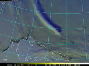
A false-color RGB image derived from 1-km resolution NOAA-18 AVHRR data showed a long, narrow cloud plume streaming northwestward from Bennett Island.
Checking out the Bennett Plume—In the CIMSS Satellite Blog,Scott Bachmeierrecently used satellite images to analyze a long, narrow cloud plume that stretched off Bennett Island, an island north of Russia, on March 12. Bachmeier discussed the research that attributes the plume to the terrain on the island forcing air to gain altitude as the land rises. The plume is further enhanced by the changes in the atmosphere that occur as wind interacts with mountains. Bachmeier pointed out features apparent in satellite images to discuss the properties of the cloud plume as well as environmental factors that could have contributed to the cloud’s formation.
Recently published papers—The Journal of Climate recently included a paper co-authored by Yinghui Liu, Jeff Key (NOAA at SSEC) andXuanji Wang. Titled “The Influence of Changes in Cloud Cover on Recent Surface Temperature Trends in the Arctic,” the paper describes a method to assess the influence of changes in Arctic cloud cover on the surface temperature trend.