Capturing Wisconsin’s Autumn in Satellite Imagery
Weather satellite instruments can do more than track the latest storm. They also offer a unique view of Earth and how it is changing, including the changes in seasons, from the stark white images in winter to the bright green of spring and summer. This image of Wisconsin on a cloud-free day, October 13, 2013, provides a dramatic satellite perspective of our state in autumn.
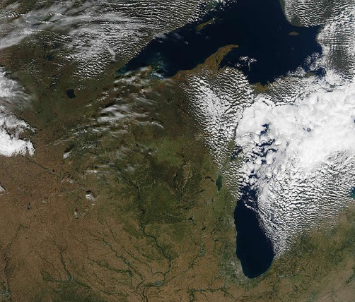
Aqua MODIS image of the upper Midwest on October 13, 2013 at 1000-meter resolution.
Credit: SSEC, MODIS Today (http://ge.ssec.wisc.edu/modis-today/credits.html)
Utilizing a direct broadcast processing system developed at the Space Science and Engineering Center (SSEC), the data used to create this composite were captured in real-time from the Moderate Resolution Imaging Spectroradiometer (MODIS). The MODIS sensor is carried on the Terra and Aqua satellites, both part of NASA’s Earth Observing System.
Together, Terra MODIS and Aqua MODIS are synced to image the complete Earth surface every one to two days. Terra travels north to south over the equator in the morning while Aqua follows in the afternoon.
With Terra launched in 1999 and Aqua in 2002, the wealth of data gathered is providing scientists at SSEC and around the world with information that is improving awareness and understanding of processes on the Earth’s surface and in lower levels of the atmosphere.
By Jean Phillips