SSEC Instruments to Ride Unmanned Drones into Hurricanes
Millions of Americans live dangerously exposed to the dangers of hurricanes. While hurricane track prediction has improved, the ability to predict changes in hurricane intensity has suffered from a lack of information about the internal workings of these mammoth storms, and a poor understanding of what causes them to increase in intensity.
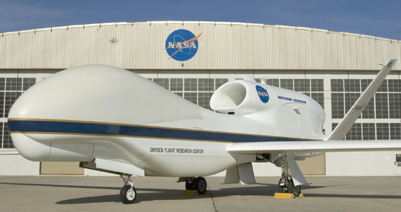
Researchers and engineers at SSEC are participating in NASA’s 5-year Hurricane and Severe Storm Sentinel (HS3) mission. This mission, with 3 years of unmanned aircraft flights, is specifically targeted to investigate the processes of hurricane formation and intensity change in the Atlantic basin area.
The HS3 mission will investigate the processes that underlie hurricane formation and intensity change in the Atlantic Ocean basin. The mission will utilize two Global Hawk unmanned drones flying at altitudes between 55,000 and 65,000 feet, with flights lasting 24 hours each. One drone’s instrument suite will measure the environment surrounding the storm and the other drone will focus on inner-core storm structure and processes such as eyewall and rainband winds and precipitation. The HS3 Global Hawks will fly from late August through early October, the height of hurricane season.
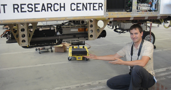
SSEC’s Scanning High-resolution Interferometer Sounder (S-HIS) will fly aboard the environment measuring drone. S-HIS is a scanning interferometer which measures emitted thermal (infrared) radiation at high spectral resolution between 3.3 and 18 microns. For this severe storm study the measured infrared radiance is primarily used to obtain temperature and water vapor profiles of the Earth’s atmosphere. The sophisticated instrument will also measure cloud radiative properties, and sea-surface/land temperature. Combined with measurements from other instruments, the S-HIS will also help define the effect that weather systems moving west from the Sahara over the Atlantic Ocean have on storm intensity.
The spatial resolution of the S-HIS is 2 km from 20 km altitude, across a 40 km ground swath. From 1998 to present, the S-HIS has been involved in 25 field experiments on several NASA vehicles.
“The NASA Global Hawk Unmanned Aircraft Systems are ideal platforms for investigations of hurricanes,” says Joe Taylor, research engineer at SSEC. “They are capable of flight altitudes greater than 55,000 feet and flight durations of up to 30 hours. We also participate in airborne science missions with the S-HIS on other NASA high altitude aircraft. These manned aircraft are of similar size and payload capacity and are also capable of high altitude, but are limited to less than 8 hour flight durations.”
SSEC scientists will also be working on the mission level goals, and will make use of data from various instruments in the HS3 scientific payload, as well as satellite data. Final planning for the HS3 mission took place in May at NASA’s Wallops Island (VA) facility.
Scientists from the CIMSS Tropical Cyclone Research Group will collaborate with Principal Investigators from the Jet Propulsion Laboratory to compare the warm core structures of the storms measured by the Global Hawk instruments with those observed from satellites. CIMSS will also provide specialized satellite products in support of mission planning, post-experiment analysis, and GOES-R proving ground activities.
Over the next two years the HS3 mission will have similar field seasons to continue the hurricane study.
The Wisconsin State Journal covered the HS3 story on their front page on 05 June 2012.


