All Ways Forward: SSEC scientists, partners prepared for GOES-R launch
Credit: Sarah Witman.
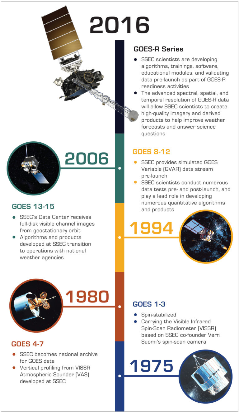
For 40 years, Geostationary Operational Environmental Satellites (GOES) have been serving a critical role in monitoring weather systems over the United States. And for just as long – even longer – the Space Science and Engineering Center (SSEC) and its Cooperative Institute for Meteorological Satellite Studies (CIMSS) at the University of Wisconsin-Madison have been proposing, testing, and evaluating each generation of satellite instruments and sensors, as well as analyzing their data.
Positioned 22,300 miles above Earth are two GOES satellites, one situated over the east coast of the United States, and the other over the west. Together, they provide nearly continuous imagery and data, enabling meteorologists to monitor and track weather systems that affect the contiguous United States as well as the Pacific and Atlantic Oceans, Central and South America, and Southern Canada.
Developed through a partnership between NASA and the National Oceanic and Atmospheric Administration (NOAA) that includes universities and industry, GOES satellites have been in operation since 1975. Improved weather satellite technologies, along with years of research using weather satellite data, have enabled forecasters to alert people to dangerous weather with lead times that save lives.
Now, the next generation of GOES satellites is nearing completion, with the first in the series, GOES-R, scheduled for launch on 4 November 2016.
The instruments onboard GOES-R will provide more frequent and higher resolution coverage of threatening weather systems, such as tornadoes and hurricanes. But, they will also provide unprecedented monitoring of environmental phenomena such as fog, fire, aerosols, volcanic ash, and real-time mapping of lightning.
Pushing the boundaries of possible – and true to the Wisconsin Idea – SSEC and CIMSS researchers continue their legacy of partnering with federal scientists on GOES-R to improve satellite-imaging capabilities to advance knowledge of weather and climate on Earth for the benefit of society.
By Jean Phillips
Featured image: GOES-R rendering. Credit: NOAA/NESDIS.