Surface
Research Categories | All Research Projects
In addition to atmospheric research, we monitor and study the Earth’s surface. Surface-based research includes monitoring flood, wildfire, and burn scar conditions to identify hazards to the public. Our efforts also support work done by the Antarctic Meteorological Research and Data Center and the investigation of Arctic sea ice conditions and trends. We also develop and support ground-based active and passive remote sensing instruments and programs.
-
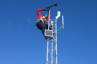
Antarctic Meteorological Research and Data Center (AMRDC)
The Antarctic Meteorological Research and Data Center (AMRDC) is an observational research and data center providing an accessible and reliable method of obtaining Antarctic meteorological data. In addition to establishing a data repository for Antarctic meteorological campaigns and projects, the AMRDC generates and hosts real-time Antarctic meteorological data from throughout the community, including data from the UW-Madison Automatic Weather Station (AWS) Program and Antarctic satellite composite imagery.
Website:
https://amrdc.ssec.wisc.edu/Contact:
Matthew Lazzara (PI), David MikolajczykCategories:
Polar Research, SurfaceSponsors:
NSF -
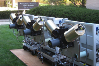
Atmospheric Emitted Radiance Interferometer (AERI)
A ground-based instrument developed by SSEC, the Atmospheric Emitted Radiance Interferometer (AERI) measures temperature, water vapor, and trace gases in the boundary layer.
Website:
http://www.ssec.wisc.edu/aeri/Contact:
Jonathan Gero (PI), Denny HackelCategories:
Instruments, SurfaceSponsors:
DOE -
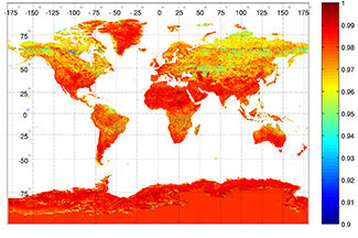
Global IR Emissivity
This project derives algorithms for and global databases of infrared land surface emissivity using input from the Moderate Resolution Imaging Spectroradiometer (MODIS), the Advanced Spaceborne Thermal Emission and Reflection Radiometer (ASTER), as well as a combined MODIS-ASTER database.
Website:
http://cimss.ssec.wisc.edu/iremis/Contact:
Eva Borbas (PI)Categories:
Surface -
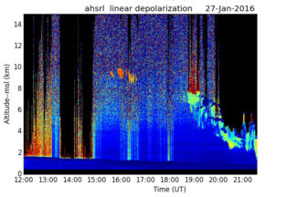
Light Detection And Ranging (LIDAR)
SSEC has developed two LIght Detection And Ranging (Lidar) instruments to take highly detailed atmospheric measurements used in numerical model development: the Volume Imaging Lidar and the High Spectral Resolution Lidar.
Website:
http://lidar.ssec.wisc.edu/Contact:
Ed Eloranta (PI), Joe GarciaCategories:
Instruments, Surface -

Reliable Automated Instrumentation Network (RAIN)
SSEC, in collaboration with other departments on campus, maintains a Reliable Automated Instrumentation Network (RAIN) for research purposes. On the AOSS building rooftop, instruments measure atmospheric parameters, while North, South, East, and West facing cameras record weather events. A buoy on Lake Mendota monitors lake quality and weather conditions.
Website:
http://metobs.ssec.wisc.eduContact:
Tim Wagner, Jonathan Thom, David Hoese, Fred BestCategories:
Instruments, SurfaceSponsors:
NOAA -
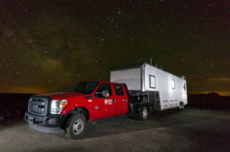
SSEC Portable Atmospheric Research Center (SPARC)
The SSEC Portable Atmospheric Research Center (SPARC) is a vehicle outfitted with a suite of instruments to make ground-based measurements used for studying the atmosphere during field campaigns across the country. The SPARC is part of the U.S. National Science Foundation’s (NSF) Facilities for Atmospheric Research and Education (FARE) Community Instruments and Facilities (CIF) program.
Website:
https://www.ssec.wisc.edu/sparc/Contact:
Jonathan Gero (PI), Tim WagnerCategories:
Instruments, Surface -
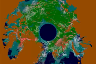
Sea Ice Leads
This project detects and characterizes sea ice leads (fractures in the ice sheet) using data from the polar orbiting Moderate Resolution Imaging Spectroradiometer (MODIS) and the Visible Infrared Imaging Radiometer Suite (VIIRS) instruments.
Website:
https://www.ssec.wisc.edu/leads/Contact:
Jay HoffmanCategories:
Polar Research, SurfaceSponsors:
NASA -
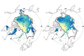
Sea Ice Products
Using satellite data, NOAA and CIMSS scientists are studying sea ice trends in the polar regions.
Contact:
Yinghui Liu, NOAA STAR (PI), Xuanji Wang, Jeff KeyCategories:
Polar Research, SurfaceSponsors:
NOAA -
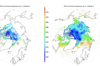
Snow Cover/Ice Surface Temperature
This cryosphere research involves algorithm development to identify ice and snow cover and estimate ice concentration and ice surface temperature over water surfaces using information from satellite observations and other products.
Contact:
Yinghui Liu, NOAA STAR (PI), Xuanji Wang, Jeff KeyCategories:
Polar Research, SurfaceSponsors:
NOAA -
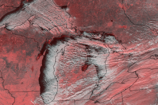
Snowfall Microphysics + Radar Observatory (lake effect snow)
The snowfall microphysics + radar observatory research program collects and catalogs sustained snowflake particle size distribution and habit type measurements to understand how microphysical details affect radar signatures.
Contact:
Norm Wood, Tristan L’EcuyerCategories:
SurfaceSponsors:
NASA
