World Meteorological Organization workshop focuses on satellite remote sensing of volcanic ash
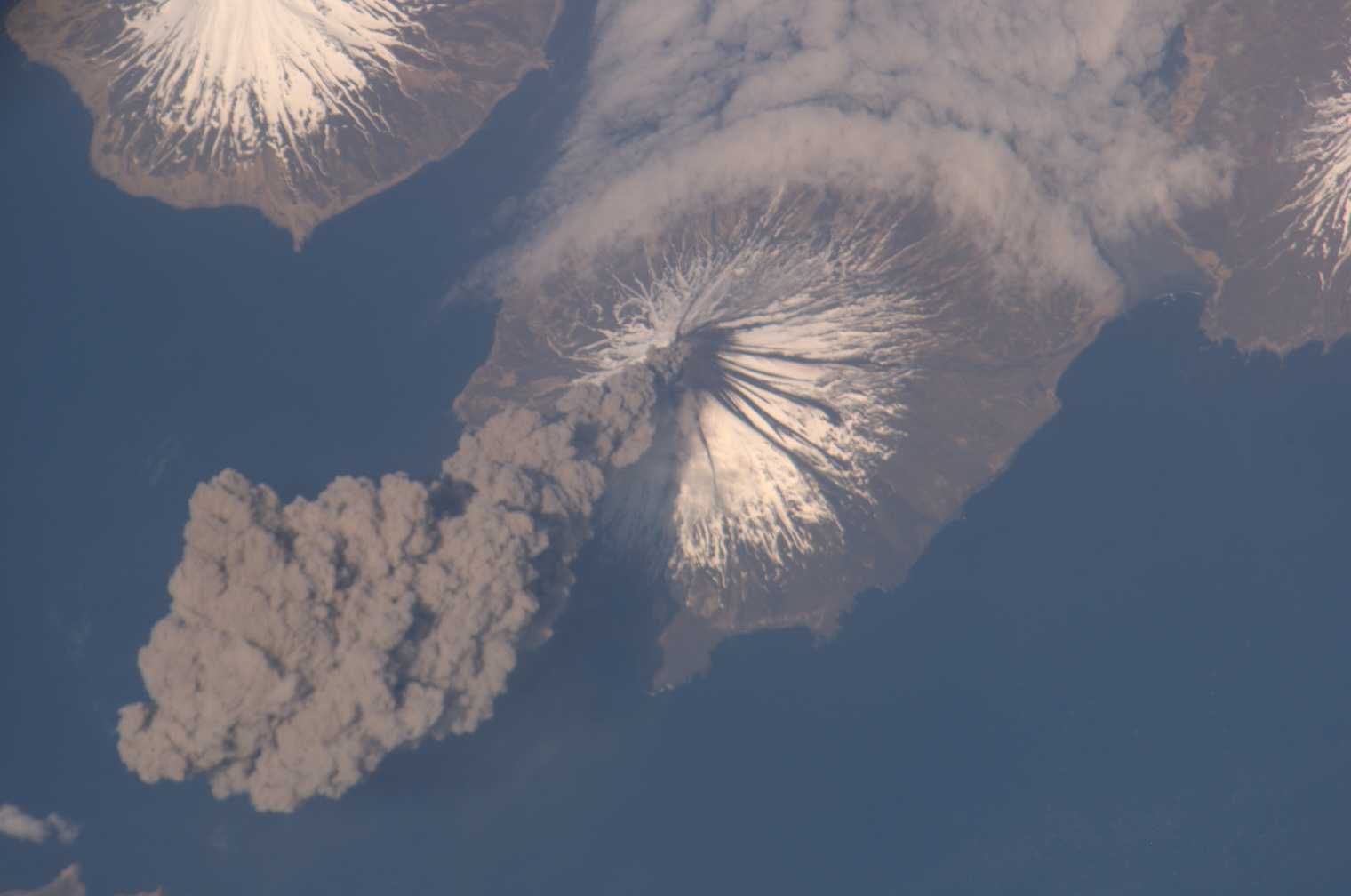
The May 2006 eruption of Mount Cleveland in the Aleutian Islands, Alaska, photographed by a crewmember on the International Space Station. Credit: NASA.
Nearly 40 international experts in meteorology, volcanology, and satellite science have gathered in Madison, Wisconsin, this week for a workshop sponsored by the World Meteorological Organization (WMO).
With participants from all but one continent, the WMO Intercomparison of Satellite-based Volcanic Ash Retrieval Algorithms Workshop is the first global attempt to assess and document the current state of science in regard to satellite observations of volcanic ash, and design a roadmap for the future direction of the field.
In particular, the workshop’s attendees are focusing on the algorithms — varying in scope and complexity — that transform volcanic ash satellite data into useful information for research and forecasting.
“Satellites do not directly measure the things that we need to examine,” explained Mike Pavolonis, a National Oceanic and Atmospheric Administration (NOAA) scientist based at the UW-Madison Cooperative Institute for Meteorological Satellite Studies, the local hosts of the workshop. “We need to apply scientific concepts and algorithms to extract meaning from those data.”
Volcanic ash satellite data plays an important role in aviation safety, a major priority of the WMO. The workshop provides an opportunity for premiere experts to discuss how to best keep aircraft out of harm’s way during an eruption, as well as minimize economic impacts.
Pavolonis added that next-generation satellites are increasingly capable of tracking the hazardous ash, providing more information for those who need to make decisions about flying and risk assessment.
The workshop is also part of the Sustained Coordinated Processing of Environmental Satellite Data for Nowcasting (SCOPE) Nowcasting Initiative, a WMO-sponsored effort to provide universal consistency and universal access to satellite data for nowcasting: short-term forecasts for a variety of weather conditions, including hazardous phenomena such as volcanic ash.
“SCOPE is intended to harmonize the information provided by the world’s satellites, which are operated by a number of different meteorological and space agencies,” Pavolonis explained, “such that no matter where you are on the globe you can have consistent information on these hazards, as much as possible.”
In addition to unifying satellite output on a global scale, a major goal of SCOPE is facilitating the acquisition of satellite data for countries that lack the capabilities. Pavolonis said this will certainly be a point of discussion at the workshop.
“How do we make end products derived from satellite data more broadly accessible? We don’t have a solution yet,” he said.
After the workshop, attendees will help compile a report that will be sent to the International Civil Aviation Organization (ICAO), the flagship organization responsible for coordinating global air traffic.
As the demand for, and volume of, air travel continues to grow, Pavolonis explained, the scientific community faces ever-evolving challenges to ensure aviation safety by using satellite data to its best advantage. Through activities such as this workshop, the WMO aims to facilitate worldwide solutions.
by Sarah Witman