Mobile-friendly weather site comes to an end
One of the world’s first mobile-friendly weather sites has reached retirement. The PDA Animated Weather (or PAW) website has provided near real-time weather data to mobile users since 2006.
Fifteen years ago, the world of mobile weather apps (or mobile data in general) was in its infancy. The PAW website took inspiration from one of the earliest commercially available mobile devices developed by Palm, the Personal Digital Assistant TX, which featured a color screen and mobile card inside that allowed users to access the Web. Perhaps trivial by today’s standards, to UW-Madison Space Science and Engineering Center researcher Russ Dengel, it was an exciting proposition to be able to see current weather reports and conditions from anywhere.
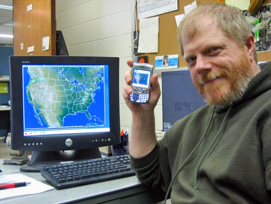
“After we got the first version up and running, all of a sudden I had an animated radar in my hand,” says Dengel. “I showed anyone I could throughout our office, and that was the start of it.”
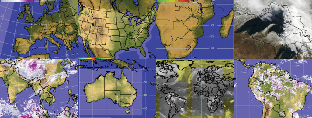
Dengel, now retired, continues to work on SSEC projects that bring satellite weather data to global users. The PAW website provided the impetus for SSEC’s RealEarth, a web-based tool that allows the user to visualize Earth imagery over a map interface. It has grown to feature a wide variety of land, oceanic and atmospheric imagery and satellite products.
SSEC’s history in weather visualization dates to the late 70s when researchers like Dengel began creating digital renderings of weather conditions and forecasts using the Man-computer Interactive Data Access System or McIDAS. The PAW website is based on the McIDAS visualization software which has maintained a remarkably low page-weight, allowing for quick processing of dozens of satellite products from around the globe.
“It’s a very to-the-point website that’s all about speed and usability,” says Bill Bellon, SSEC webmaster who helped create the first version of the PAW.
Not long after the launch of the PAW, Apple released its first iPhone in 2007 and bolstered the capabilities of mobile devices and displays for animations. Dengel says the resulting boom in mobile apps quickly began to outcompete the PAW’s visual interface, but its continued simplicity (think Craigslist) proved extremely useful for devices with slow connections.
“Even as weather apps became more common and refined, we continued to see high usage of the PAW from around the world,” says Dengel. “It was common during service outages to immediately receive several emails inquiring about the site’s status.”
In fact, one of the most popular seasonal tools provided a view of winter road conditions. Organizations from UW-Madison to those in neighboring states came to rely on this PAW feature for its reliable reporting of road conditions.
The PAW has been retired due to aging hardware. Despite its minimal design, the PAW represents a milestone in the rapid development of the web, mobile apps and SSEC’s commitment to providing essential weather data to anyone, anywhere.