Eclipse 2024 — Capturing the eclipse from all angles
From Earth’s surface to outer space, SSEC and CIMSS scientists captured the 2024 total solar eclipse from all angles on April 08.
From orbit
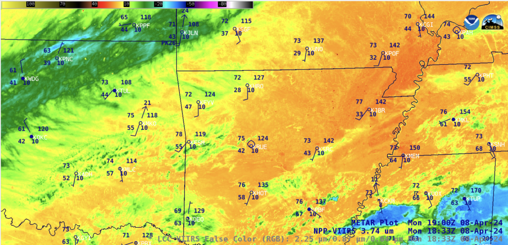
NOAA’s GOES-East satellite had a front row seat and unique view of the eclipse on April 08, 2024, sending back data and imagery every five minutes as the path of totality spanned across North America.
SSEC tracked the eclipse in near real-time using GOES-East Advanced Baseline Imager and SUVI instrument to view of the Earth as well as the Sun behind it: https://www.ssec.wisc.edu/datacenter/eclipse2024
A 4k video made from 55 images captured by NOAA’s GOES-East weather satellite beginning at 16:10 UTC and ending 20:35 UTC.
From the surface
The SSEC Portable Atmospheric Research Center is a mobile research lab that has travelled thousands of kilometers across the US to collect valuable atmospheric data.
On April 08, the SPARC set up within the path of totality near Indianapolis, Indiana to collect data during the blackout, which presents unique atmospheric conditions.
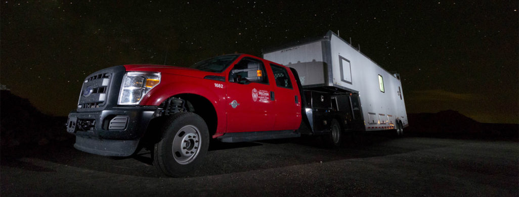
“It’s basically a sunset at the wrong time and it happens quickly,” says Jonathan Gero, an SSEC scientist who operates the SPARC. “What you’re getting are interesting changes in how the Earth is heated from the Sun, that short absence can have noticeable impacts on the atmosphere.”
From the web
CIMSS researchers Scott Lindstrom and Scott Bachmeier covered the eclipse extensively, posting on the CIMSS Satellite Blog that features eye-catching satellite imagery and explanations of the solar phenomenon. Take a look at some of the blog’s latest posts and past entries on eclipses here.