Monthly News Summary- February 2005
Earth Observatory Looks into MODIS Polar Winds
by Jen O’Leary
NASA’s online newsletter Earth Observatory recently acknowledged the importance of CIMSS’s polar winds research in the improvment of weather forecasting. Calculating the speed, height and direction of winds in the earth’s polar regions, satellite data fills in forecasting observational gaps and significantly extends a mid-range forecast’s scope of accuracy.
|
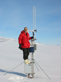
photo courtesy of Jeff Key Jeff Key on the automatic weather station tower. |
Earth Observatory reporter Rebecca Lindsey offers CIMSS glowing praise for this product’s current uses as well as the ingenuity of its development. Jeff Key (NOAA team leader at SSEC) and a team of colleagues created a Polar Winds product using imagery from NASA’s Terra satellite and later their Aqua satellite. The satellites gather data about the polar regions at a frequency that allows scientists to estimate the speed and direction of winds in that area.
In addition to conceptualizing the product, Key, Chris Velden andDave Santek (all with CIMSS) developed a unique approach to analyze the incoming data. Santek used existing software and modified it to find and track cloud and water vapor data from a polar-orbiting satellite. In the article, Lindsey quotes polar winds users from the European Centre for Medium-range Weather Forecasts (ECMWF) discussing how integral MODIS data became in their forecasts despite early skepticism.
“[I]ndirect measurements [using satellite data] have errors and biases that are difficult to account for in the analysis systems, as we had seen before with wind observations from geostationary satellites. We certainly did not scoff at the idea that these satellite winds could be helpful, but I think we also did not expect quite such a positive impact,” ECMWF’s Neils Bormann said in the article.
Many meteorologists question the utility of satellite data in forecasting because the observations gleaned from such data are indirect and sit nestled in multiple assumptions. Lindsey touches on this issue in her article, but does not specifically address why the Polar Winds product proves so useful.
“[Global] models also use … satellite data, particularly from atmospheric sounders, so the models should do winds reasonably well,” Key said in explanation. “But they don’t, probably because of difficulties in using the sounder radiances, and because the sounders don’t provide enough detailed information on rapidly changing, smaller scale weather systems. I think the MODIS polar winds fill gaps in our conventional observing systems, and provide wind information in greater spatial detail than other satellite instruments.”
White out the evening news: WKOW-TV (Madison Channel 27) and Fox 47 TV covered the hazards of working in Antarctica and making it “off the ice” before southern winter sets in. Reporter Carl Agnelli spoke with Jim Yeck about the neutrino telescope being constructed at the South Pole, Ice Cube, which is managed from the Antarctic Astronomy and Astrophysics Research Institute at the University of Wisconsin–Madison (A3RI). He also interviewed researcher George Weidner (Department of Atmospheric and Oceanic Sciences) about SSEC’s Automatic Weather Stations program. Weidner described some of the aspects of working in a “white on white” and very cold environment. The piece appeared on the 6 p.m. news on January 18.
Good weather for meteorologists: by Terri Gregory
For an article on Antarctica weather, SSEC’s Antarctic Meteorological Research Center provided satellite images prominently featuring the Antarctic Peninsula. Each image also shows the long tip of South America. D.E. Pedgley wrote of “Gales, snow and fog—two weeks of Antarctic summer” inWeather, a magazine produced by the United Kingdom’s Royal Meteorological Society.
New ways to track winds: A group of CIMSS scientists demonstrated the concept of using new satellite data to track winds in the lowest region of the atmosphere. Previously, the group confirmed the possibility using simulated data and data from instruments flown aboard various aircraft. Hyperspectral capabilities became a reality in 2003 with NASA’s deployment of AIRS, a specialized satellite instrument. The CIMSS Winds group recently used data from this instrument to generate the initial attempt to observe winds using real hyperspectral data. Paul Menzel (NESDIS) devised the original concept. The CIMSS Sounding team, headed by Allen Huang and Jun Li, retrieved the satellite data that Dave Santek and Chris Velden of the Winds group used in the initial experiments.
 |
|---|
|
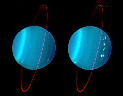
One of Lawrence Sromovsky’s images
|
Stormy weather: The February edition of Sky and Telescopefeatures an article about the storms on Uranus. Reporter Robert Naeve spoke withLawrence Sromovsky (SSEC) who leads a team of researchers in analyzing imagery from the Keck II telescope in Hawaii. Sromovsky and colleague Patrick Fry(SSEC) believe that the storm may have been occurring when Voyager 2 flew by in 1986. Sromovosky’s images were used with the article.
NASA uses winds data: MODIS Polar Winds work by Jeff Key and Chris Velden made the cover story in the December 2004 issue of the Joint Center for Satellite Data Assimilation’s quarterly newsletter. Pat Pauley, a professor with the Navy’s post-graduate school, used their Polar Winds product in her research for the Navy. The article was based on a similar presentation at this year’s annual American Meteorological Society meeting.
 |
|---|
|
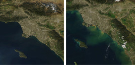
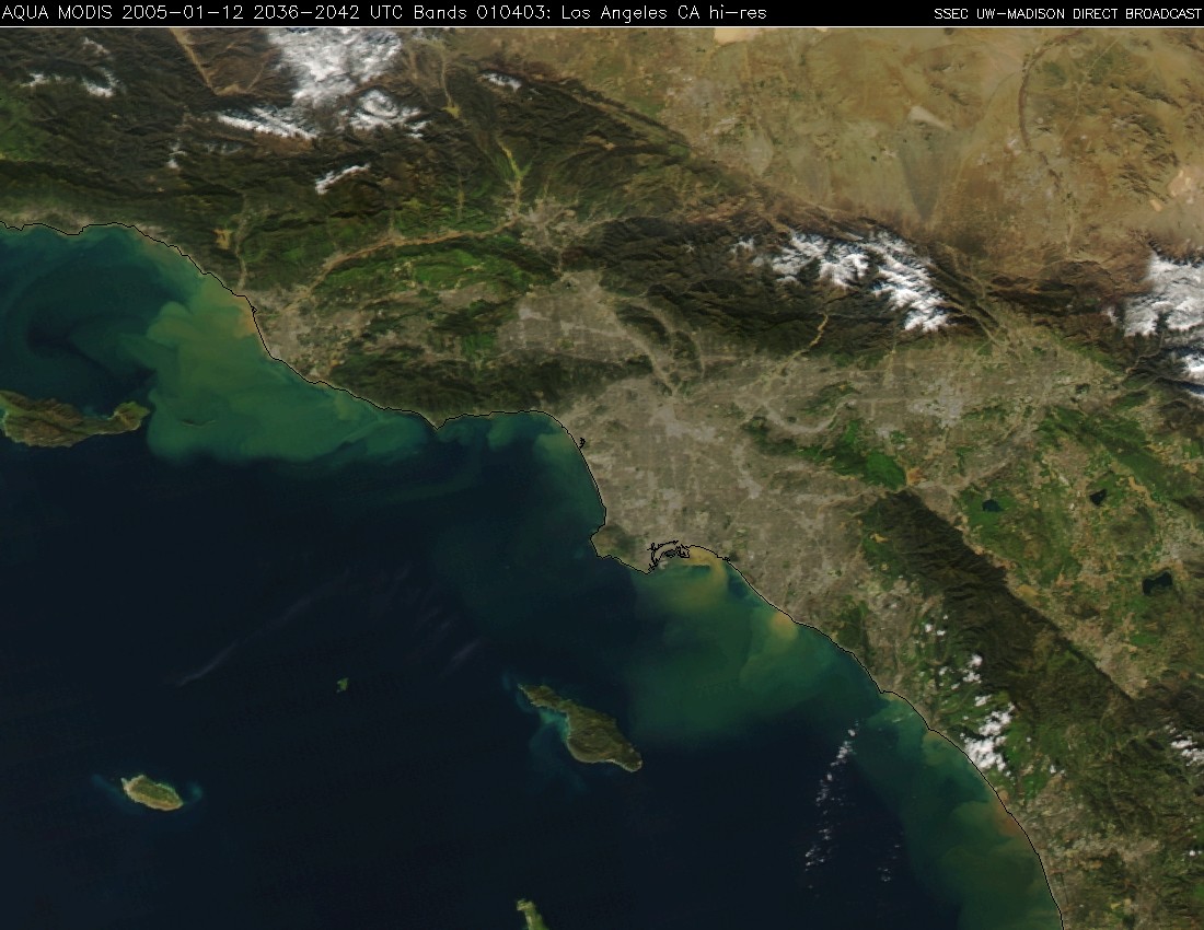
California coastline in December 2004 (left) and Janurary 2005 (right)
|
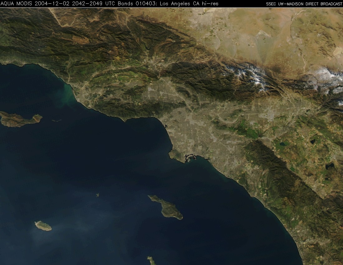
Off the California coast: After comparing MODIS imagery from December 2, 2004 and January 12, 2005, CIMSS scientists noticed a flow of sediments off the shores of L.A. running from the L.A. basin into the Pacific Ocean. They speculate that CA’s record rainfall and related flooding and landslides that occurred in early January caused this.
Guided by GOES: Missile defense testing in Hawaii will soon use GOES sounder Cloud Top Pressure (CTP) data. Beginning in March 2005, this data will help detect high altitude cirrus clouds. Currently, missile tests use airborne optical sensors sensitive enough to detect these clouds, but the airborne molecules impair the sensor’s focusing abilities.
As seen on TV: NOVA, a WGBH Boston production, used SSECHurricane Ivan imagery in a program that aired on January 25 on the localPBS affiliate channel 21.
A milestone: Chris Velden (CIMSS) and Tim Olander (CIMSS) of theCIMSS Tropical Cyclones group recently released a new version of the Advanced Objective Dvorak Technique (AODT) with significantly better performance when estimating hurricane intensity using satellite information. The National Weather Service will implement the new AODT at the Tropical Prediction Center in Miami, FL in time for use in this year’s hurricane season.
 |
|---|
|
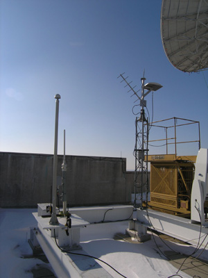
photo curtosey of Maciek Smuga The radiosonde antenna joins the accoutrements on the center’s roof. |
Launching a new system: On Janunary 25, SSEC launched the first meteorological balloon under a new Vaisala radiosonde system. Implementing the new system involved installing a new antenna on the center’s roof, adding to the various and sundry accoutrements residing atop the building. Wayne Feltz states that the data gathered by this system could be compared with the data from other instruments, helping to validate the accuracy of all involved.
AMS groupies take over California: by Terri Gregory
Drawing 2,600 scientists and others interested in the atmospheric and earth sciences, the 85th annual meeting of the American Meteorological Societytook place in January in San Diego, CA. While treated to some of the worst weather the area has ever experienced, SSEC presenters and exhibiters were content with temperatures in the 40s to 60s, having escaped the single-digit weather of Wisconsin. Although enjoying the chance to thaw, they were not in San Diego for the weather, but to present papers and posters, network with collaborators, and exhibit scientific wares.
 |
|---|
|
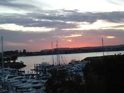
photo courtesy of Terri Gregory
Sunset in San Diego |
The annual meeting combines symposia in many areas. SSEC researchers and NOAA employees stationed in Madison gave presentations of both papers and posters in these symposia: Education; Hydrology; Interactive Information Processing Systems (IIPS) for Meteorology, Oceanography, and Hydrology; Lidar Atmospheric Applications; Polar Meteorology and Oceanography; Atmospheric Science Librarians International (ASLI) Conference; History. Check out theprogram itinerary on the Web.
 |
|---|
|
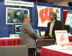
photo courtesy of Terri GregoryTom Whittaker
(left) and Tom Achtor at the SSEC booth |
SSEC and NOAA/NESDIS researchers also gave many presentations in the GOES-R/NPOESS Symposium. In the Ninth Symposium on Integrated Observing and Assimilation Systems for the Atmosphere, Oceans, and Land Surface, SSEC Director Hank Revercomb, with a host of co-authors, presented “Atmospheric InfraRed Sounder (AIRS) radiance validation with the Scanning High-resolution Interferometer Sounder (S-HIS) aircraft instrument” and Dave Santek later spoke on “Error characteristics of satellite-derived atmospheric motion vectors.”
In addition to the center’s physical presence in San Diego, SSEC was noted inThe Daily BAMS, a newsletter published and distributed during the meeting. CIMSS’ new supercomputer, an SGI Altix 3700, was featured in “Parcels” on Monday, January 10. The computer purchase was funded by the Defense University Research Instrumentation Program that sponsors university research. Some organizations’ promotional items included SSEC imagery and research: Unidata’s eye-catching bookmark features both the SSEC global montage and the sea surface temperature images. NOAA’s “noaaresearch” brochure features the sea surface temperature image. NOAA’s “The NESDIS Cooperative Research Program” profiles both the Advanced Satellite Products Branch, NOAA’s research group stationed at SSEC, and the Cooperative Institute for Meteorological Satellite Studies, listing research capabilities of each.
- Take a look at SSEC photos from the meeting
Learning new tricks: In early January, Bob Aune (NOAA with CIMSS) learned how to acquire and implement the Gridded Statistical Interpolation (GSI) system at the first GSI users’ orientation held at the Environmental Modeling Center (EMC) in Camp Springs, MD. Scientists plan to implement the GSI, a new three-dimensional variational analysis system, in both regional and global modeling systems. CIMSS wants to use the GSI alongside the next generation of the operational mesoscale model and to use the code in testing satellite data assimilation algorithms.
Looking ahead: Margaret Mooney with SSEC’s Office of Space Science Education joined forces with Van Valaskey and Gary Graper to prepare a Science Alliance/UW-Madison exhibit at the annual meeting of the Wisconsin Society of Science Teachers (WSST) in LaCrosse on this coming April 14, 15 and 16. All three are members of UW- Madison’s Science Alliance, a group formed to advocate and pursue science outreach. Mooney hopes to provide an opportunity for scientists to connect with local science teachers and to promote the center’s outreach programs.
Teaching award noted: by Terri Gregory
The UW-Madison official campus newspaper, Wisconsin Week, noted in their January 12 edition that Emeritus Professor Donald R. Johnson received an award for teaching at the annual meeting of the American Meteorological Society. The Teaching Excellence Award recognizes “sustained outstanding teaching and mentoring of undergraduate or graduate students in atmospheric, oceanic and related sciences.” Johnson is retired from teaching but is a scientist with the Space Science and Engineering Center and the National Weather Service, and directs Earth Sciences for the Universities Space Research Association.
Some annual recognition: The UW-Madison’s 2003-2004 annual report included acknowledgments of SSEC projects beginning with Wisconsin Weather Stories. The report also mentioned PEOPLE, Science Expeditions, and IceCube.
One of SSEC’s journalism students: by Terri Gregory
Journalism student Clint Robus, employed in SSEC’s shipping and receiving area, recently completed the UW School of Journalism and Mass Communication’s application-only magazine production course. Over fall semester, journalism students take on professional roles to produce an issue ofCURB. Robus’ piece, “Innocence Lost,” features the stories of two of his high school classmates, Laura Schultz and Carlye Garcia, who served in Iraq with the Army National Guard. Garcia received a Purple Heart for bravery. Robus contrasts his experiences as a homeside student with those of Schultz and Garcia as well as of his brother, a Navy enlistee. His article respectfully honors the sacrifices these three made.“Every member of the military deserves that sign of respect,” Robus said. SSEC employs many undergraduate students in areas outside their field of interest, to help finance their education. Usually, their achievements in their field of study are unknown and separate from their work in SSEC.