How do scientists create clear, vivid images of the Earth without using a camera?
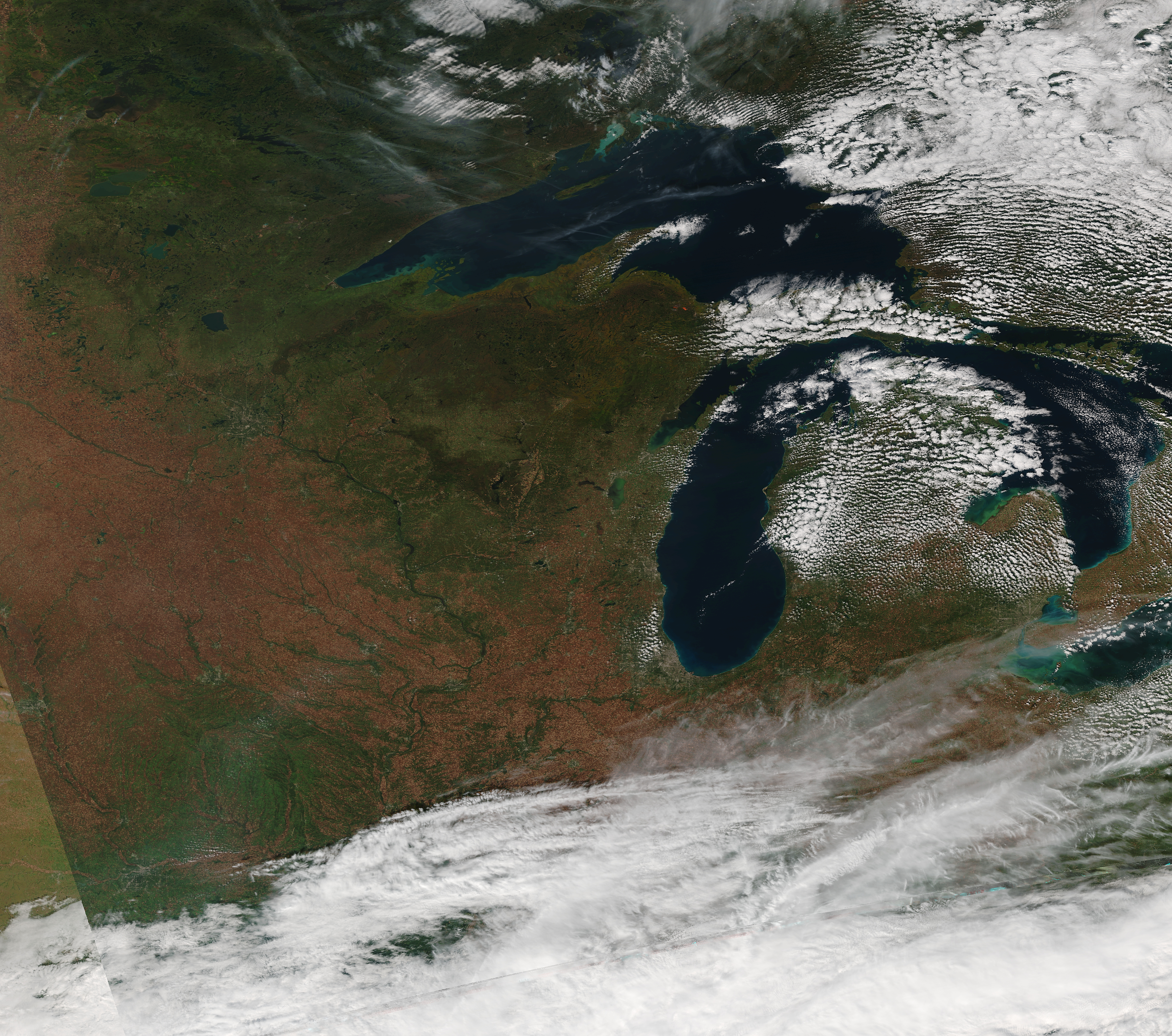
This image, showing a satellite’s view of the Great Lakes region, was created at SSEC using data collected by Suomi NPP VIIRS on Oct. 11, 2014.
From the Spin-Scan Cloud Camera to Google Earth, tools and techniques used to process and visualize satellite imagery have evolved over the past 40 years, but the concept has stayed the same.
This image of the Great Lakes region was processed by scientists at the Space Science and Engineering Center (SSEC), University of Wisconsin-Madison. Large volumes of data collected by the Visible Infrared Imaging Radiometer Suite (VIIRS) instrument onboard the Suomi National Polar-orbiting Partnership (NPP) spacecraft were combined to make one, composite image. VIIRS is one of the newest, most advanced instruments in the evolution of radiometric imaging technology.
As Suomi NPP completes its polar orbit, at a distance of 512 miles, VIIRS scans sections of the Earth’s surface in swaths more than 1,000 miles wide. The instrument’s sensor detects and measures radiation, or light energy (usually sunlight) emitted or reflected off of surfaces. Those data are recorded and transmitted to ground stations, which can then be translated into a digital image.
Unlike in situ measurements taken at the source, remote sensing instruments such as VIIRS can collect atmospheric and surface data from areas of Earth that might otherwise be inaccessible. In addition, since VIIRS collects both visible and infrared imagery, it has night-and-day coverage.
The VIIRS radiometric measurements also provide information on various land, sea, ice, and atmospheric properties such as motion, temperature, and color. That the gradations of fall color represented in this image are so finely detailed is owed to technological advances that have resulted in better and higher resolution.
The VIIRS instrument will also be included on the JPSS-1 satellite mission scheduled for launch in 2017. SSEC scientists will continue to analyze the data to increase understanding of global weather and climate patterns as an aid to forecasting.
More imagery from Suomi NPP VIIRS may be found on the CIMSS Satellite Blog.