Scientists as trainers: GOES-R, JPSS short course prepares practitioners
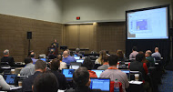
Attendees at the AMS 2016 Short Course on GOES-R and JPSS. Credit: Michelle Smith, NASA.
Researchers at the UW-Madison Cooperative Institute for Meteorological Satellite Studies (CIMSS) are gearing up for the launch of a new generation of weather satellites: the Geostationary Operational Environmental Satellite (GOES-R) in 2016 and the Joint Polar Satellite System (JPSS) in 2017.
But scientists will not be the only users of the improved data and capabilities that come with these advanced satellites – before and after launch, scores of practitioners will need to be trained so that they can provide improved services to their customers.
According to Tim Schmit, an atmospheric scientist with NOAA’s Advanced Satellite Products Branch at CIMSS, broadcast and consulting meteorologists, forecasters, and many others who communicate with public audiences want to be prepared to utilize and explain the enhanced features of these satellites as soon as the data are available.
With training needs growing and launch dates looming, Schmit and a host of CIMSS instructors held their second GOES-R and JPSS Short Course on Sunday, the opening day of the American Meteorological Society’s Annual Meeting in New Orleans.
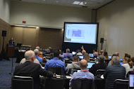
The course in session. Credit: Michelle Smith, NASA.
“We aimed the course at this very specific target audience of learners,” said CIMSS scientist Mat Gunshor, one of the instructors, “and the class was full.” In fact, a number of the students traveled to New Orleans from other countries to take advantage of the short course opportunity while attending the AMS conferences.
Planners packed a wealth of information into the one-day, hands-on course. Participants delved into the features of the Advanced Baseline Imager (ABI) on GOES-R that will provide better and faster imaging and navigation, more spectral bands, and higher spatial resolution.
Other instructors covered capabilities of the new Geostationary Lightning Mapper (GLM) and how to derive information from satellite data in order to locate fires or other hot spots.
Combined with the improved environmental information from the Visible Infrared Imaging Radiometer Suite (VIIRS) – which features a day/night view of Earth – and the other instruments on JPSS, the new measurements from the two satellites will result in more accurate forecasts and warnings of high impact weather and other atmospheric phenomena.
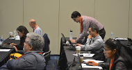
Jordan Gerth (pictured) and five other SSEC/CIMSS scientists collaboratively instructed the course. Credit: Michelle Smith, NASA.
Schmit and Gunshor agree that a unique aspect of the course format is its hands-on component through which attendees can interact with simulated data and immediately obtain results to review and discuss.
All materials, including the hands-on exercises, are available online.
In addition to Schmit and Gunshor, scientists Jordan Gerth, Chad Gravelle, Scott Lindstrom, and Chris Schmidt rounded out the CIMSS teaching team.
The CIMSS scientists plan to offer another course in summer 2016 to reach even more broadcast meteorologists who interact with and inform public audiences.