Data ‘rescue’ project blends analog, digital technologies
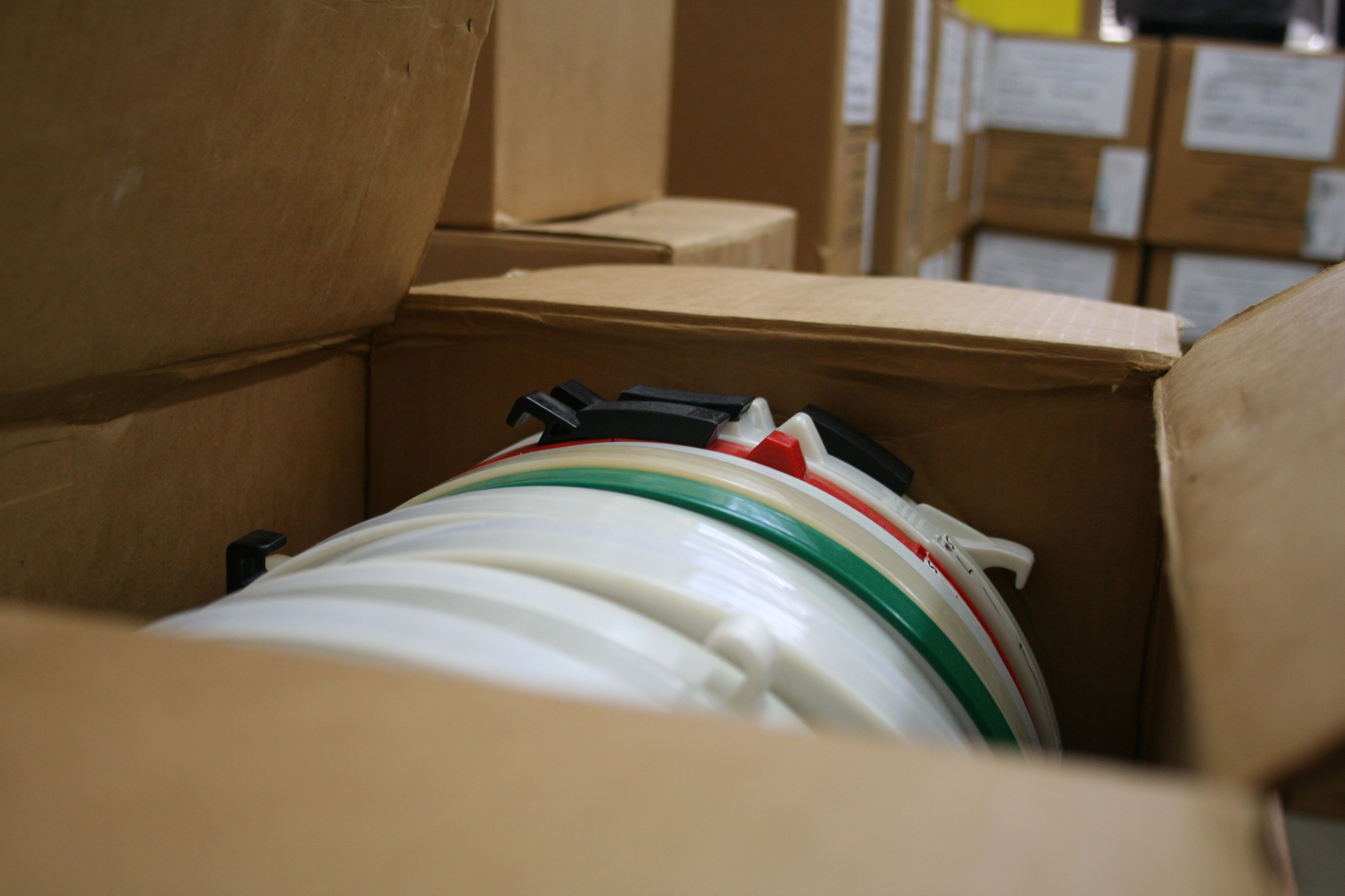
One of 95 boxes of nine-track tape reels the SSEC Data Center is digitizing and value-adding for NASA’s Goddard Space Flight Center. Credit: Sarah Witman.
The Space Science and Engineering Center (SSEC) Data Center receives and archives massive amounts of satellite data each day, distributed to thousands of users around the world. A new project, however, calls for a slightly different set of skills — hearkening back to a time when SSEC operated in analog.
By special request from NASA’s Goddard Space Flight Center last fall, SSEC Data Center staff Dan Forrest, Nancy Troxel-Hoehn, Douglas Ratcliff, and Jerry Robaidek, and University of Wisconsin-Madison computer sciences student Chad Hammacher, have spent the past eight months attempting to read, digitize, and decode data from more than 1,400 nine-track tape reels from the 1970s and ’80s.
Currently occupying 95 cardboard boxes (emblazoned with the NASA logo) the reels contain data transmitted by two early NASA satellites: Synchronous Meteorological Satellites (SMS) 1 and 2, launched in 1974 and 1975, respectively. But the team won’t know exactly what is on the tapes until they have been read (they are a little over halfway there), and then decoded by Forrest.
Not only is SSEC one of the few organizations with the requisite equipment and expertise, but these data, if usable, will fill a gap in the Data Center’s historical archive — making it the perfect place to conduct this “data rescue” effort, says Robaidek.
Nine-track tape was the most common form of data storage at that time, relying on a series of eight-bit characters recorded on half-inch wide magnetic tape. While the Data Center is equipped to handle “big data,” Robaidek says, these tapes will likely contain less than a terabyte altogether.
“The amount of data on each tape has varied, but we’ve found that most hold about 25 megabytes, and many were not filled to capacity,” says Ratcliff. “It’s not a lot of data by today’s standards, but it is important data.”
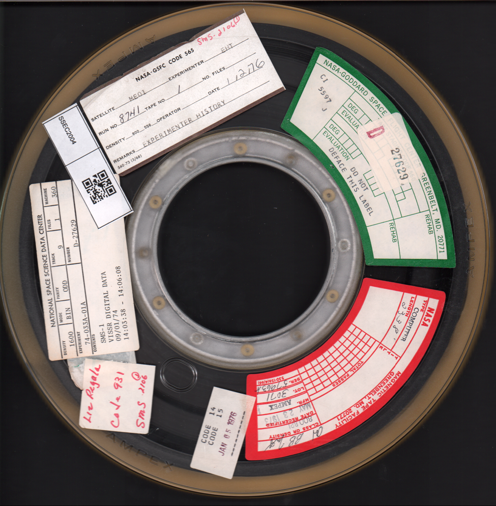
A scan of a nine-track tape reel from the SSEC data rescue project. Credit: SSEC Data Center.
Extracting those data, so far, has been a labor-intensive process, he says. Each reel must be scanned on a flatbed scanner to record information (or metadata) about its contents, then read on a nine-track tape drive, then entered into an online workspace. If all goes well, this can take 20-30 minutes per reel.
The process is somewhat delicate, Robaidek explains, since the iron oxide coating on nine-track tape gradually erodes during each reading.
Furthermore, “the binders that adhere the iron oxide to the plastic are known to degrade over time,” says Schwerdtfeger Library director Jean Phillips, adding that the lifespan of these media often depends on their storage conditions. If the reels had previously been stored lying flat or in a non-climate-controlled environment, that could accelerate degradation.
Some of the tapes, therefore, might only survive one or two readings before becoming completely obscured. If a reel is deemed unreadable by the first of two nine-track tape drives at SSEC, procured specially for the project, Forrest assumes the responsibility of what he calls “beating on bits,” says Ratcliff, to try to coax out some usable information with the second tape drive.
Once the team has sent the digitized data and metadata back to NASA, Forrest will lead an effort to decode the files using software he developed – making the imagery viewable to the human eye – and make them publicly available.
Forrest already used the software to decode a sample tape from NASA last year. That sample, Robaidek says, contained SMS-2 satellite imagery from 6 May 1975 — an infamous date in meteorological history, as a major tornado outbreak swept across Omaha, Nebraska, killing three people and injuring more than 100.
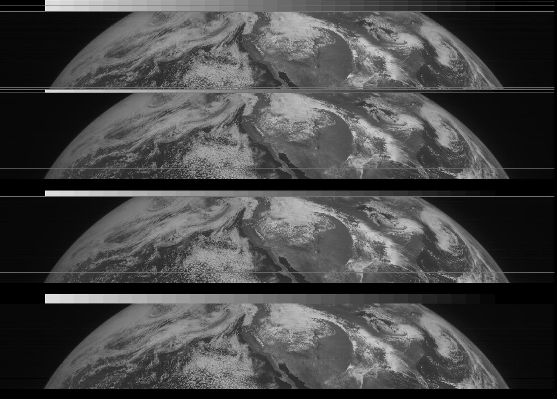
Five-minute imagery created from 6 May 1975 Synchronous Meteorological Satellites (SMS) data by SSEC Data Center staff as a “sample” for the data rescue project. Credit: SSEC Data Center.
That this sample tape was so poignant makes Robaidek even more curious to find out what remains on the full collection.
“These data don’t exist digitally anywhere in the world. Some have probably not been seen since they were originally scanned in the 1970s,” he says. “We have been speculating whether data and imagery from the night of the Edmund Fitzgerald wreck could be in this.”
The storm that sunk the S.S. Edmund Fitzgerald, a Great Lakes freighter, causing the tragic loss of its entire crew, is one that is well documented colloquially (perhaps most notably by Canadian songwriter Gordon Lightfoot’s 1976 hit) but still perplexes meteorologists. For example, Cooperative Institute for Meteorological Satellite Studies (CIMSS) director Steve Ackerman has explored the event in great detail. However, very little satellite data exists from that evening, so the prospect that these reels could help shed some light on the circumstances leading up to the wreck is heartening.
It just so happens that a weather-satellite data rescue is closely, fundamentally tied to SSEC’s history. In the early years of satellite meteorology, the National Oceanic and Atmospheric Administration (NOAA) regularly overwrote data as a way to reuse and conserve computer reel tapes. As such, a national archive of satellite-transmitted data did not exist until 1979, when SSEC co-founder Verner Suomi suggested that such a record could prove advantageous to future generations of scientists.
The archive was a videocassette-based digital system. SSEC happened to be the most suitable location for such an archive, since it was Suomi’s son, Eric, an engineer working at SSEC, who had developed a unique method for recording and storing GOES satellite data on U-matic tape cartridges in 1977-78.
Eric Suomi “designed and perfected the modification of video recording machines to record digital data,” recalls SSEC building manager Dave Jones. “It was a method of recording that was well before its time.”
Video recorders were ideal for this application, in part, because they had high bandwidths and long recording times. And the format of successive satellite scans to build a picture of the Earth matched well with the successive scans written onto the videocassettes, says Jones.
“At that time, long before I started working at SSEC, we hired students to change the tapes manually in the middle of the night, to keep a continuous record,” Robaidek recalls.
Ratcliff notes that the archival process would have been laborious, much more so than presently. To transfer data would have taken as much time, or more, than the documented event.
“Three months of real-time data would have taken three months to pull from a tape,” he says, “and if the request was for a certain section they would have had to manually stop and start.”
SSEC remained the National Archive of Satellite Data until 2004, when the National Climatic Data Center (NCDC) took it over – however, the Data Center is often able to provide a backup for the archive during East Coast outages. To this day, the Data Center maintains a digital archive of all the GOES data ever transmitted, plus data from several other geostationary satellites worldwide, making it the largest archive – and growing – of geostationary weather-satellite data in the world.
by Sarah Witman