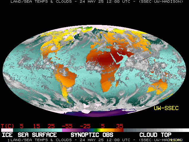
Global Satellite & Surface Temperature Montage

Images and movies
About this imagery
This global montage imagery is a Mollweide projection composite image of cloud top, synoptic observation, and sea surface temperatures. The cloud image is a combination of GMS, GOES-8 and Meteosat imagery. A grid of temperatures, obtained from synoptic observations every six hours, is made into an image and merged with an image of Sea Surface Temperatures, generated daily from an NMC SST grid.
An algorithm was created to compare the surface temperature (SST over water or synoptic observation temperature over land) with the infrared temperatures from the satellite imagery. Using this algorithm, the composite image uses the cloud values if an IR temperature is more than 14 degrees Kelvin colder than the surface temperature. This algorithm improved cloud/no-cloud classification by including marine stratus and filtering out clear areas that are very cold, such as polar regions.
Please note that because these images are the result of processing a variety of weather data with a computer algorithm, there can be images that will show incorrect cloud cover and may have missing areas in the image. This is due to missing data, errors in the data itself, and the fact that no algorithm for filtering out clear areas in satellite data (so that SST and surface temperature can be displayed along with cloud cover) will be 100% effective. These images are for educational and general information purposes and are not meant for serious scientific, commercial, or other purposes. For such data and algorithms, please refer to our research section.
