How remote-sensing improves your daily life
by Sarah Witman
Remote-sensing technology is a major component of much of the work being conducted at the Space Science and Engineering Center (SSEC) at the University of Wisconsin-Madison – but just what is remote sensing?
Remote sensing describes any form of measurement taken from afar: whether it’s detecting sea-surface temperature from a satellite in orbit, or calculating the amount of ozone in the atmosphere from ground-based instruments. While some environmental measurements can easily be taken at the source, such as a backyard rain gauge, this is not always logistically possible. Many quantities or properties can only be measured, or are most efficiently measured, remotely.
While this concept might be new to some, remote-sensing technology affects – and improves – our daily lives in a number of ways (at least a dozen, according to the following list). Remote sensing helps us…
1. Fly safely
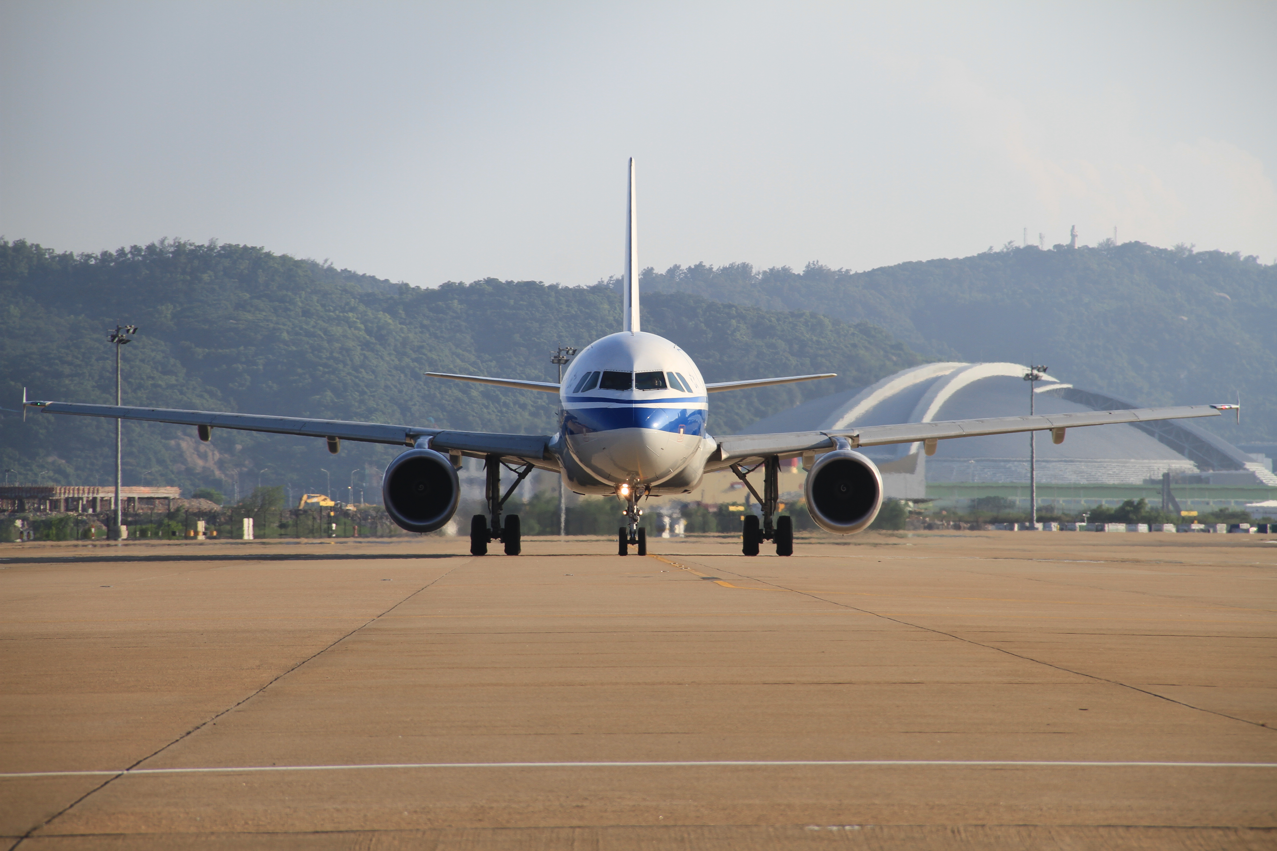
Credit: Wikimedia Commons.
Satellite remote-sensing allows scientists to monitor dust and ash from volcanic eruptions, which are hazardous for aircraft. With more detailed, current information about hazards in their flight-path, pilots can better assess risks and make informed decisions before taking off. This is increasingly important as the volume of worldwide air traffic continues to increase, says Mike Pavolonis, a National Oceanic and Atmospheric Administration (NOAA) scientist based at UW-Madison’s Cooperative Institute for Meteorological Satellite Studies (CIMSS).
Furthermore, Pavolonis says, models that rely on satellite data are an effective way to more accurately predict severe weather, such as thunderstorms, one of the most threatening conditions in aviation. Traditional weather-prediction measures, such as radar, are limited – they can only provide information when a storm is in a more mature state. Satellite remote-sensing offers a greater perspective by starting when severe weather begins to develop. Pavolonis, along with other scientists at CIMSS, developed a model called ProbSevere that uses satellite data to calculate the probability that a developing storm will produce severe weather in the next 60 minutes.
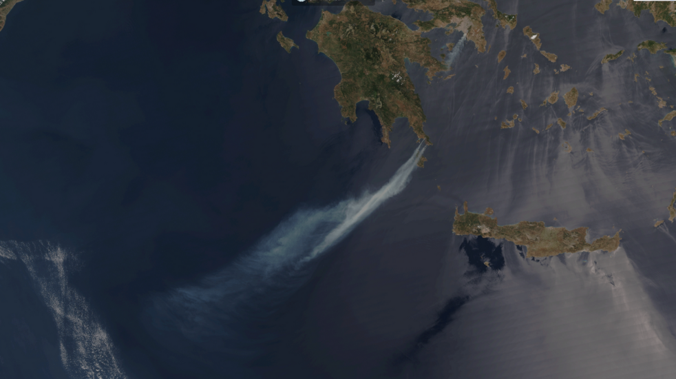
2. Breathe clean air
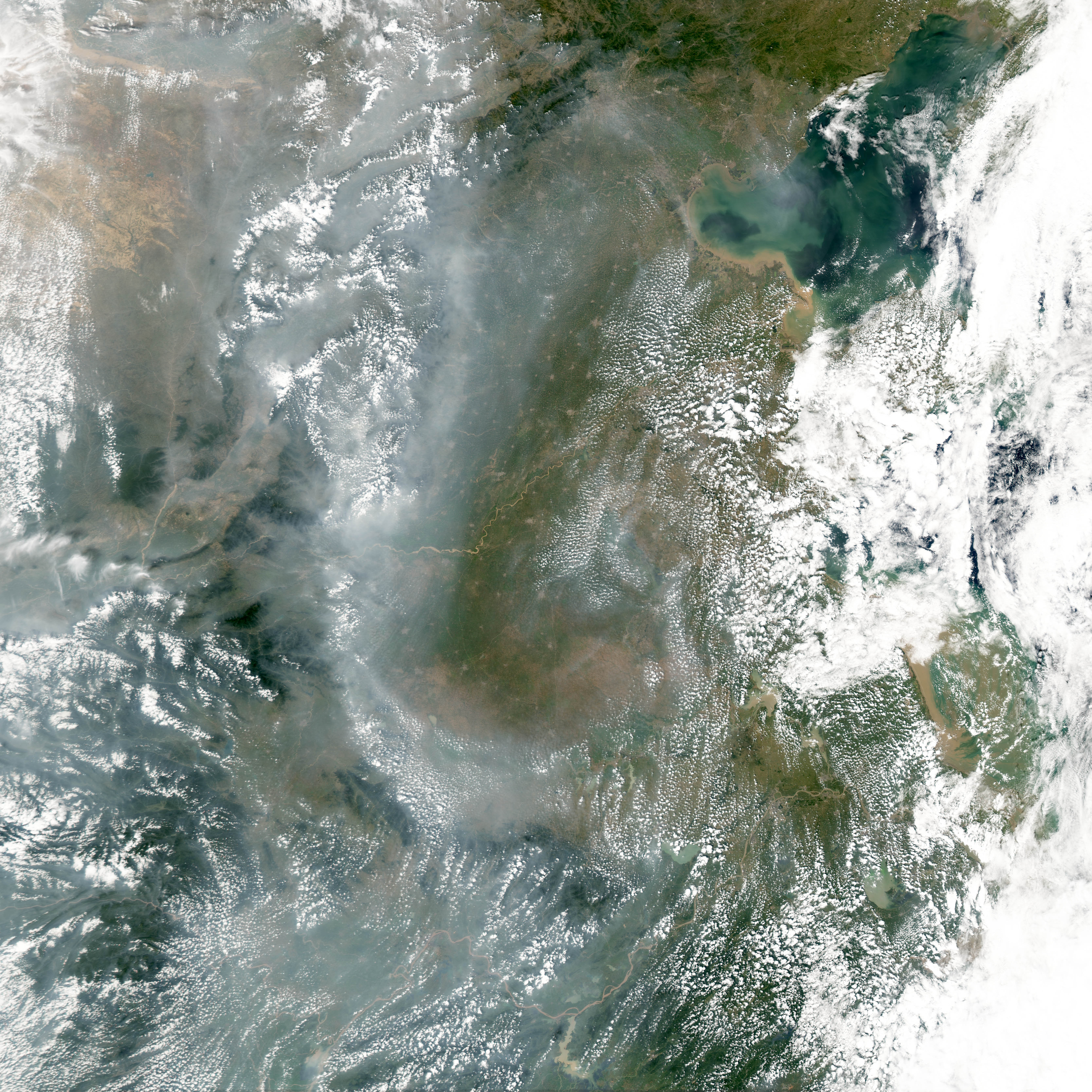
Credit: NASA Earth Observatory.
Air pollution is a well-known cause of health problems, such as trouble breathing and eye, nose, and throat irritation. Remote-sensing data can be used to support targeted warnings for the people who are most affected by poor air quality, such as asthmatics, but they can also help inform policy-makers in charge of regulating air pollutants.
Scientists use data collected by satellites to create detailed, timely visualizations of air pollution in major cities. By creating animated satellite imagery of air pollution events, they can also track the movements of smog (gasses and particulate matter in the air) as it is transported, sometimes long distances. Numerous examples of such imagery may be found on the CIMSS Satellite Blog.
Air quality models, which utilize data from satellites as well as airborne and ground-based instruments, are another effective tool for scientists studying air pollution. For example, the Real-time Air Quality Modeling System (RAQMS) developed at UW-Madison uses large volumes of data from NASA’s Terra, Aqua, and Aura satellites. In addition to providing crucial support for air quality studies, these types of models are important for making data-driven decisions related to global and regional air quality.
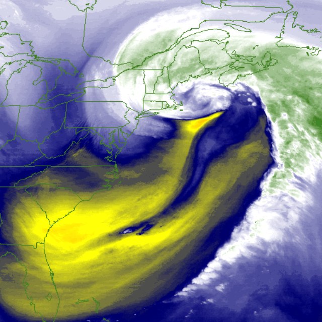
3. Plan for hurricanes and other tropical storms
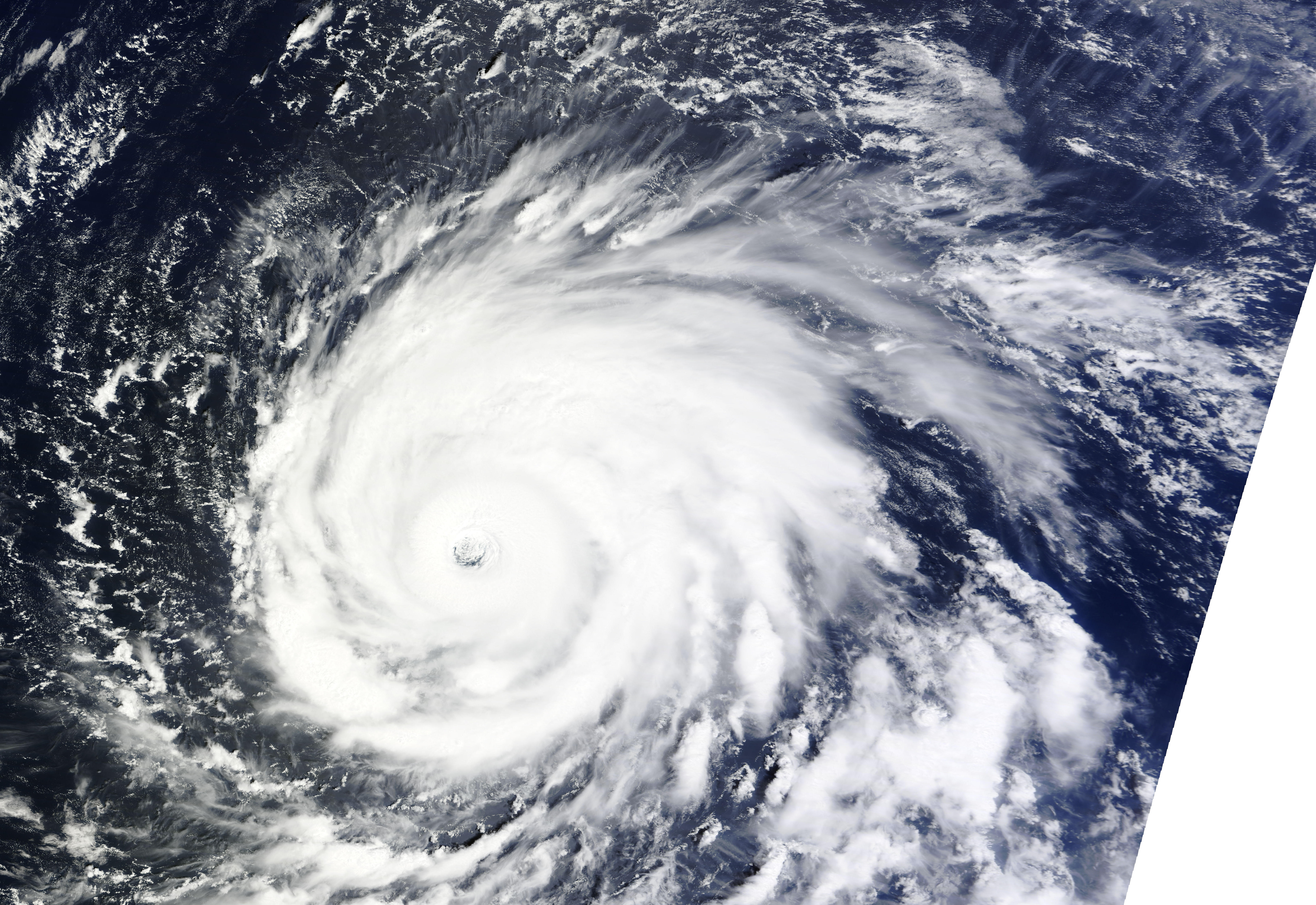
Credit: NASA Earth Observatory.
Tropical cyclones and hurricanes have a huge impact on public safety when they make landfall, and cost billions of dollars in damages each year – Hurricane Katrina alone caused more than $100 billion, according to estimates from the National Oceanic and Atmospheric Administration (NOAA).
So that forecasters can accurately predict these powerful, and potentially deadly, storms – and give the public ample time to prepare – scientists must be able to collect data on the conditions at play when tropical storms form, persist, and dissipate. For more than two decades, CIMSS’ tropical cyclones group has been a leader in providing the weather community with satellite-data tools, imagery, and training.
Another effort, funded by NASA, entails flying unmanned aircraft over the Atlantic Ocean to track hurricanes. Specialized instrumentation developed by scientists at SSEC flies onboard to measure properties such as temperature and water vapor. Over time, these data will tell an important story about the life cycles of hurricanes.
Moreover, decades of satellite data are now allowing scientists to examine storms historically, in order to better understand their formation and behavior – as well as observe changing patterns and trends. For example, a study led by Jim Kossin, a NOAA scientist stationed at CIMSS, analyzed 30 years of satellite data and found that tropical cyclones are gradually reaching their maximum intensities farther away from the equator.
4. Plan for severe storms on land
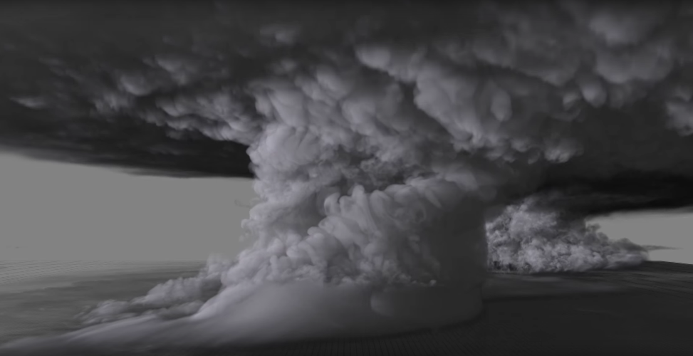
Credit: Leigh Orf, SSEC.
Severe weather that forms on land, including thunderstorms and tornadoes, is chaotic and therefore difficult to predict.
The ProbSevere model, mentioned above, is one important example of how remote-sensing data is improving our response time to severe weather. Another advanced model developed at CIMSS is specifically targeted to enable communities to plan for and become more resilient to natural disasters. This publicly available model, developed in conjunction with the U.S. Department of Homeland Security, allows the user to simulate the path of a tornado to calculate potential damages and losses.
Techniques for visualizing storms, such as the award-winning simulation from SSEC scientist Leigh Orf seen above, are getting more sophisticated all the time, too, allowing scientists to see the data in living color as they study them.
Meanwhile, instruments deployed on the ground and aboard aircraft are being used to collect data before storms even hit, to better understand the conditions in which they form. Just last summer, for the PECAN field campaign, a network of instruments (both ground-based and aircraft-based remote-sensing instruments) were deployed across Kansas and surrounding states to study nighttime convection.
5. Withstand wintry weather
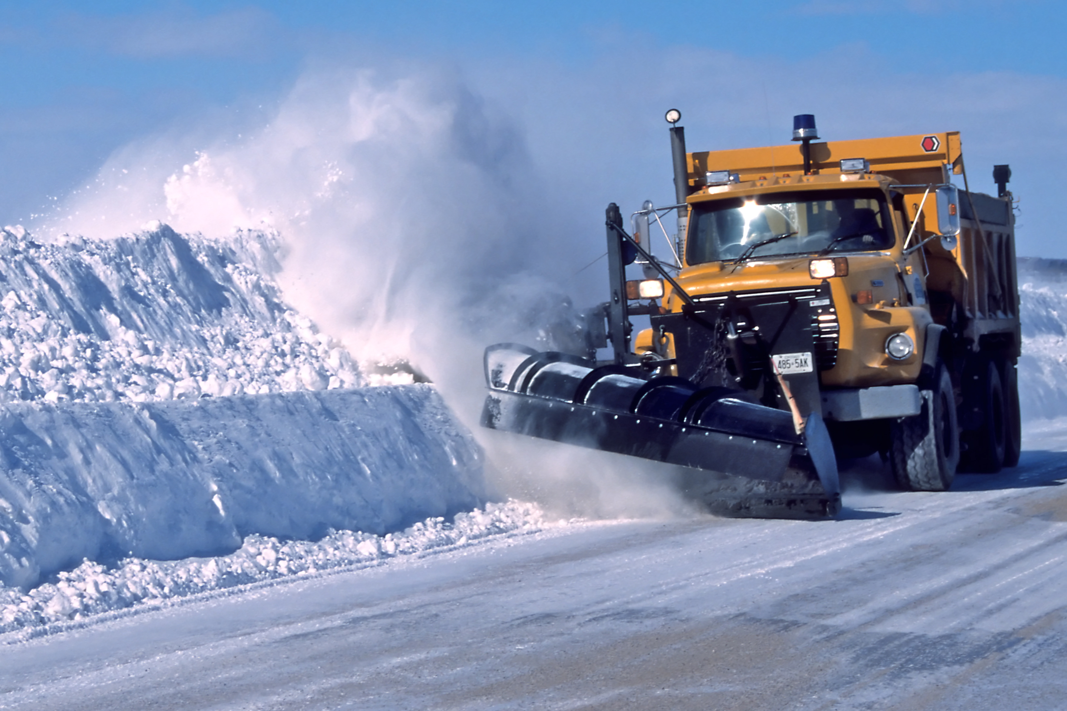
Credit: Wikimedia Commons.
Lake-effect and bay-effect snow, common forms of heavy snowfall, are relatively difficult to study. For example, lake-effect snow often forms at less than a kilometer off the ground (fairly shallow for snow), so the SSEC scientists studying its formation and behavior in northern Michigan must use a combination of satellite instrumentation, radars, and specialized ground-based devices.
Satellite instruments are now sophisticated enough to detect the amount and movement of moisture in the air, in order to predict snowfall. In the case of historic snowfall events, such as the blizzard that hit the East Coast this winter, visualizations of satellite data are important for scientists to both understand the phenomena and communicate the science to the public.
6. Enjoy informative (and visually appealing) weather forecasts
Credit: SSEC/CIMSS, via Weather Underground.
Whether you get your weather news on TV or from an app on your phone, your experience is most certainly enhanced by remote-sensing.
Weather data is still collected in situ (at the source) the old-fashioned way: via weather balloons, buoys, and land-based instrumentation, such as thermometers, barometers, and anemometers. However, the technology to collect weather data has expanded greatly over the years: For example, sensors on planes and ships are able to take measurements across large areas.
Satellites, of course, have improved capabilities to an even greater degree, collecting great swaths of data thousands of miles wide. Weather forecasters often use imagery crafted from satellite data, like that found on the CIMSS Satellite Blog, in their reports.
Advances in remote-sensing technology will only make these reports better. For example, next-generation satellites (such as the U.S. geostationary satellite, GOES-R, set for launch later this year) have an advanced range of capabilities to bring in higher quality data at more frequent intervals.
7. Stay safe on game day
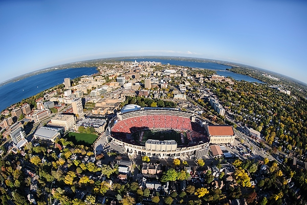
Credit: Jeff Miller, UW-Madison Communications.
If you’re a sports fanatic, remote-sensing might play an even bigger role in your daily life than for most. At UW-Madison, for example, it’s tradition for SSEC scientists to provide game-day forecasts for the Badgers football team. These scientists use advanced models, incorporating data from a variety of sources, and keep an eye on lightning and other weather phenomena that could pose a danger to players and fans on game day.
8. Prepare and respond to natural disasters, such as flooding
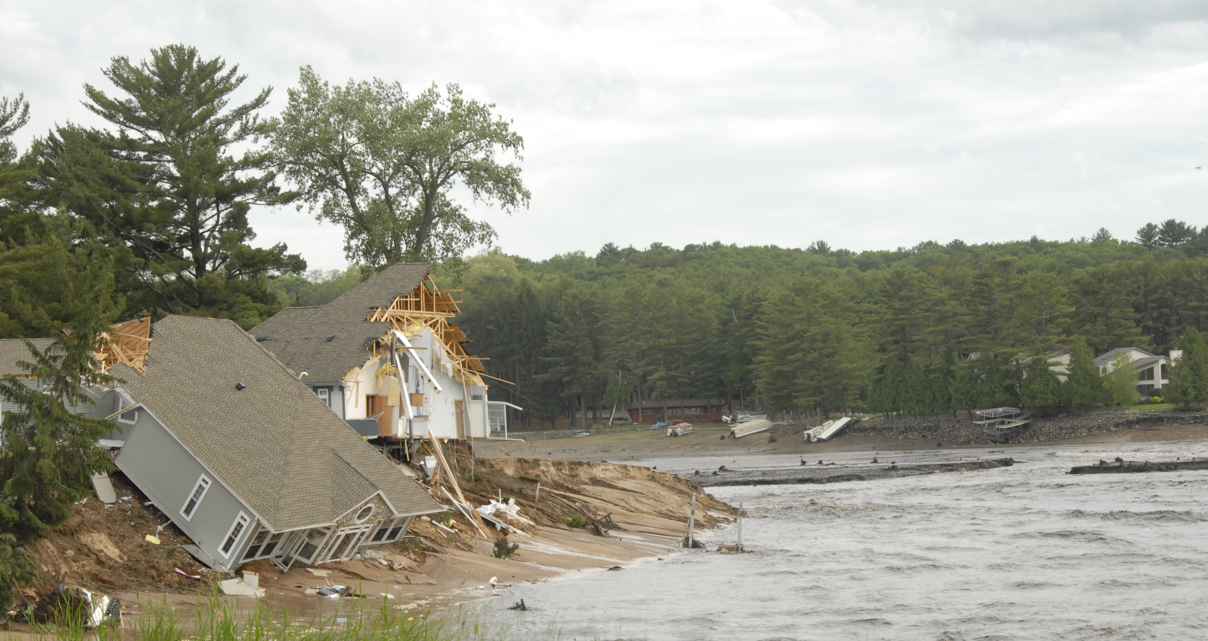
Credit: Ready Wisconsin, Wisconsin Emergency Management.
Flooding, especially flash floods, is a difficult phenomenon to predict. But scientists are working to develop ever more accurate models to give communities more forewarning. For instance, a model in development at SSEC uses water vapor data collected by satellite instrumentation to calculate the likelihood of present conditions to trigger a flood. Furthermore, predictions from global climate models suggest that extreme precipitable water vapor events will become more frequent, leading to the potential for more extreme precipitation events and flooding, over the next 100 years.
In addition to predicting hazards, CIMSS scientists are teaming up with groups interested in monitoring water-related issues, such as the United States Geological Survey (USGS) and the Federal Emergency Management Agency (FEMA), to use remote-sensing research to help facilitate effective flood-response plans.
More recently, the U.S. Army Corps of Engineers used the George Mason University River Flooding Product to layer imagery from the Suomi NPP satellite over Google Earth, allowing them to visualize flooding along the Illinois River during a severe event last December. The product, which was also used to respond to a major ice jam on the Yukon River in Alaska in 2013, is publicly available on SSEC’s RealEarth website.
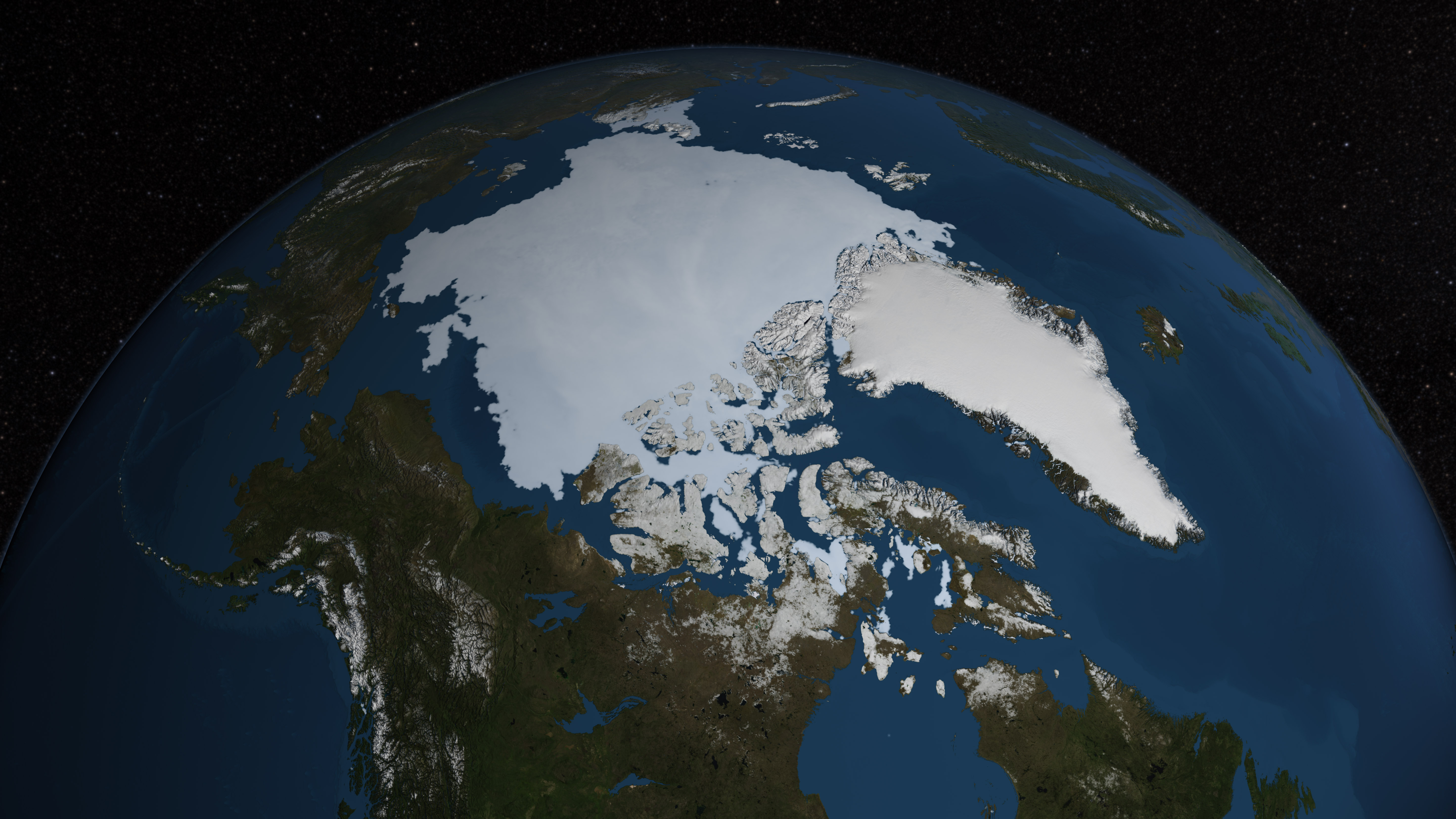
9. Keep an eye on wildfires
Credit: SSEC.
From forest fires in Montana and Washington to fires blazing across the deserts of California, it is crucial for the public to know when wildfires start – and where they are headed. Wildfires are a global issue, and they can occur even in cold, wet regions, such as Alaska, Norway, and Canada. Two years ago, wildfire smoke in the northeast even drifted over frozen ice on the Hudson Bay. (Click to see these events illustrated and animated on the CIMSS Satellite Blog.)
Fortunately, instrumentation onboard satellites are able to detect indicators of wildfires (such as smoke, ash, dust, and surface temperature) from up above – hundreds, thousands, and even tens of thousands of miles above the Earth’s surface.
Furthermore, a processing system developed by NOAA and CIMSS scientists called the Wildfire Automated Biomass Burning Algorithm (WFABBA) is able to use geostationary satellite data to detect and characterize biomass burning across nearly every continent.
10. Eat foods with minimal damage from drought

Credit: Robert Burns, Texas AgriLife Extension Service.
Scientists are working to provide intra-seasonal (1-2 month) climate and drought outlooks for ranchers and farmers: suppliers of our nation’s food resources. In addition, says SSEC scientist Jason Otkin, he and other scientists are striving to better predict “flash drought” conditions, so that landowners may take action swiftly before visible damage to vegetation sets in.
11. Pursue answers about global climate change
Credit: NASA.
Answering society’s biggest questions, such as those related to global climate change, requires proportionately robust tools and long-term data collection. The answers that scientists are able to glean have the potential to affect us all.
The first experimental verification of the greenhouse effect due to carbon dioxide at the Earth’s surface was detected through remote-sensing just last year (though calculated evidence had been established for decades). The Atmospheric Emitted Radiance Interferometer (AERI) instrument, developed at SSEC, was used to make precise measurements of thermal energy at the Earth’s surface through remote sensing.
In another study published last year, a pair of scientists at SSEC used a variety of satellite data and a simple ice-growth model to show how changes in wintertime cloud cover influence summertime sea-ice extent, information which may lead to improved seasonal sea-ice forecasts.
An ongoing collaboration between several UW-Madison scientists aims to use satellite data, along with climate and agriculture modeling, to study the impact of climate-driven changes in precipitation on small-farm agriculture in the Himalayas. The ice fields of the Himalayan mountains contain the largest reserve of freshwater outside the North and South Poles, making it an important region to study.
Furthermore, as part of a NASA Science Investigator-led Processing Systems (SIPS) contract, SSEC scientists are aiding the NASA Suomi Polar-orbiting Partnership (NPP) Science Team in the creation of a continuous Earth System Data Record (ESDR) – processing all data from the Suomi NPP satellite, launched in 2011, to compile an up-to-date archive of consistent, continuous environmental data to be used by scientists around the world.
It is through large-scale collaborations like these that we can start to not only understand, but mitigate changes in climate.
12. Get the next generation of leaders interested in science
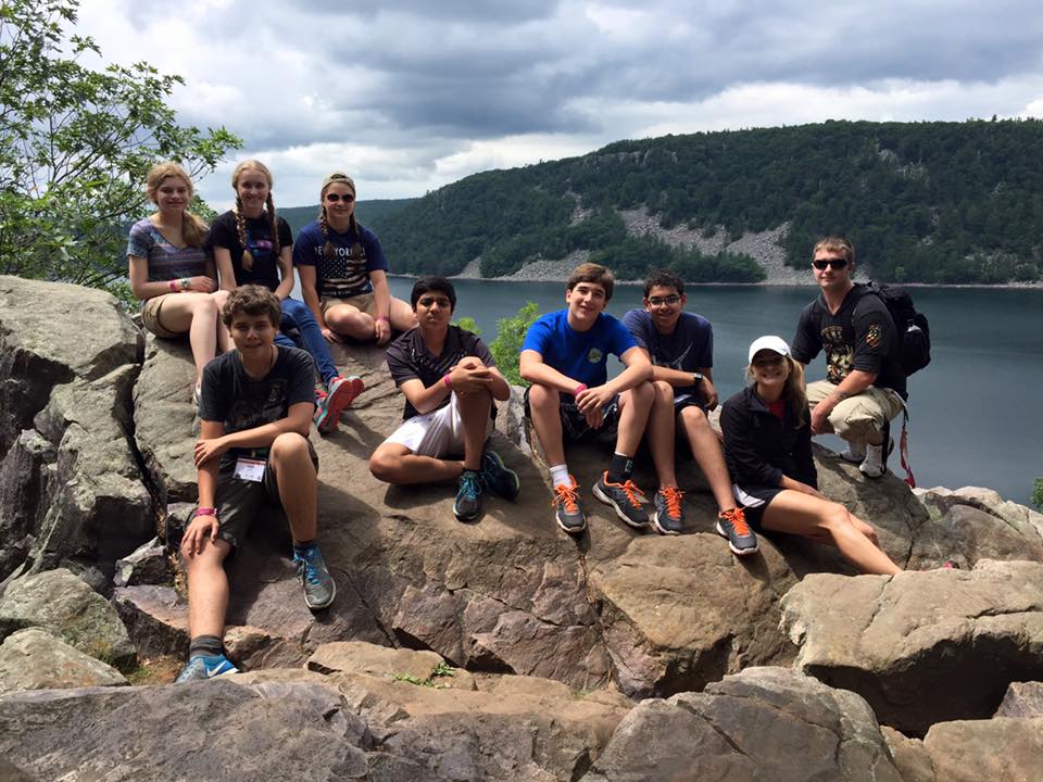
Credit: CIMSS.
Through outreach and education opportunities – such as the CIMSS Student Workshop, a remote-sensing training bootcamp in Kazakhstan taught by SSEC scientists, a UW-Madison high school science internship program, and a visiting scholars program for Indian undergraduates – high school and higher-education students are not only developing skills in remote-sensing and satellite meteorology, but also learning what it takes to become the STEM leaders of tomorrow.
With massive open online courses, such as UW-Madison’s “Changing Weather and Climate in the Great Lakes Region, these invaluable lessons are available to an even wider audience.
And, with early-learning opportunities such as Science Expeditions and Grandparents University, remote-sensing research can be the access point to get younger students interested in science. While not every participant will go on to use remote-sensing technology in higher education or their careers, they will hopefully all come away from the experience with a greater appreciation for the STEM fields – and the confidence to pursue these interests in the future.